Category : UPSC
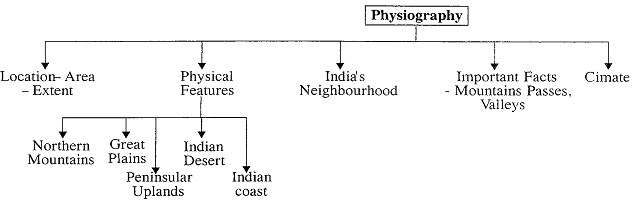
Physiography and Drainage Pattern of India
INTRODUCTION
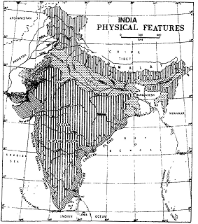
‘Physiography’ of an area is the outcome of structure, process and the stage of development. The land of India is characterized by great diversity in its physical features. It is well-marked off from the rest of Asia by mountains and He Sea, which give the country a distinct geographical unity. The North has a vast expanse of rugged topography consisting of series of mountain ranges with varied peaks, beautiful valleys and deep gorges. The South consists of stable table land with highly dissected plateaus and denuded rocks. In between these two lies the vast North Indian plain.
LOCATION - AREA - EXTENT
|
• India-Afghanistan and Pakistan - Afghanistan international boundary is called the Durand Line, determined as a “militarily strategic border between British India and Afghanistan”. • The India-China boundary (4,225 km) is a natural boundary running along the Himalayan ranges and is based on various treaties. Its eastern part (1,140 km) is called the Mc Mahon Line. • The boundary with Pakistan and Bangladesh (the East Pakistan) was finalized at the time of partition in 1947 through the ‘Red Cliffe Award’. • The Tin Bigha Corridor is a strip of land belonging to India is a part of West Bengal and lies adjacent to the Bangladesh border. In 1947, the border between India and East Pakistan (now Bangladesh) was also demarcated by Sir Redcliffe. • Sir creek forms the boundary between Gujarat State of India and Sind province of Pakistan. |
The States having Common Frontiers with Neighboring Countries
|
Country |
States |
|
Pakistan |
Jammu and Kashmir, Punjab, Rajasthan, Gujarat (4 states) |
|
Afghanistan |
Jammu and Kashmir (1 state) |
|
China |
Jammu and Kashmir, Himachal Pradesh, Uttarakhand, Sikkim Arunachal Pradesh (5 states) |
|
Nepal |
Uttarakhand, Uttar Pradesh, Bihar, West Bengal Sikkim (5 states) |
|
Bhutan |
Sikkim, West Bengal, Assam, Arunachal Pradesh (4 states) |
|
Myanmar |
Arunachal Pradesh, Nagaland, Manipur, Mizoram (4 states) |
|
Bangladesh |
West Bengal, Meghalaya, Assam, Tripura, Mizoram (5 states) |
Four Ends of India
Easternmost point of India is known as Kibithu; situated on right bank of river Lohit separating India from China-Tibet region. It is a small village with the population at the altitude of 3,350 metre in Arunachal Pradesh. Westernmost point is situated in Kuch area of Gujarat called as Ghuar Mota. The region is famous for its harsh climate with \[45\text{ }{}^\circ \]C in summer and 20°C in winter. During monsoon sea. son this region looks like tortoise surrounded by seawater. Northernmost point of India has been in controversies ever since India’s independence. The Siachen Glacier in the state of J&K is the northern boundary of India according to the official division of India during the time of Independences. The Southernmost point of the mainland of India is Kanyakumari District in the state of Tamil Nadu.
Kanyakumari, formerly was known as Cape Comorin. It is the second largest and urbanized of Tamil Nadu. Indira Point is a village in the Nicobar district of Andaman and Nicobar Islands, India. It is located in the Great Nicobar tehsil. It is the location of the southernmost point of India’s territory. Bay of Bengal and Arabian Sea meet at Indian point.
Area Wise Largest States
|
State |
sq km |
|
Rajasthan |
342239 |
|
Madhya Pradesh |
308245 |
|
Maharashtra |
307713 |
|
Andhra Pradesh |
160229 |
|
Uttar Pradesh |
240928 |
Important Straits
|
Location |
Channel |
|
Indira point-Indonesia (B.O.B) |
Great Channel |
|
Little Andaman and Nicobar (B.O.B) |
\[10{}^\circ \]Channel |
|
Minicoy-Lakshadweep (A.S) |
\[9{}^\circ \]Channel |
|
Maldives-Minicoy (A.S) |
\[8{}^\circ \]Channel |
|
India-Sri Lanka (B.O.B) |
Gulf of Mannar and Palk Strait |
|
Bay of Bengal (B.O.B) |
|
|
Arabian sea (A.S.) |
|
PHYSICAL FEATURES
Origin of Landforms
Himalaya. The Himalayan upliftment out of the Tethys sea and subsidence of the Northern flank of the Peninsular plateau resulted in the formation of a large basin. In due course of time this depression, gradually got filled with deposition of sediments by the rivers flowing from the mountains in the North and the Peninsular plateau in the South.
(a) Himadri (Greater Himalayas),
(b) Himachal (Lesser Himalayas), and
(c) The Siwaliks (Outer Himalayas).
valley (near Kedarnath).
|
Principal Peaks of India |
||
|
Peak |
Height (Mtrs) |
Location |
|
1. Mt. Everest |
8850 |
Nepal-Tibet |
|
2. Mt. K2 (Karakoram) |
8611 |
India |
|
3. Kanchenjunga |
8597 |
Nepal-India |
|
4. Dhaulagiri |
8172 |
Nepal |
|
5. Nanga Parbat |
8126 |
India |
|
6. Annapuma |
8078 |
Nepal |
|
7. Gasherbrurn |
8068 |
India |
|
8. Nanda Devi |
7817 |
India |
|
9. Mt. Kamet |
7756 |
India |
|
10. Guria Mandhata |
7728 |
Tibet |
|
Valleys |
and its locations |
|
• Araku Valley |
: Andhra Pradesh |
|
• Damodar Valley |
: Jharkhand and West Bengal |
|
• Darma Valley |
: Uttarakhand |
|
• Dzukou Valley |
: North-eastern part |
|
• Johar Valley |
: Uttarakhand |
|
• Markha Valley |
: Ladakh |
|
• Nubra Valley |
: Ladakh |
|
• Sangia Valley |
: Himachal pradesh |
|
• Saur Valley |
: Uttarakhand |
|
• Sum Valley |
: Ladakh |
|
• Tons Valley |
: Uttarakhand |
|
• Yumthang Valley |
: Sikkim |
Divisions of the Himalayas
(a) The sub-Himalayas or Siwaliks:
(b) The Lesser Himalayas or Himachal;
|
Mountain Passes of India |
|
Himalayan passes · Banihal pass - between Doda and Anantnag (Jawahar Tunnel), J & K. · Shipki La - River Sutluj enters India from Tibet, Himachal Pradesh. · Bara Lachan La - between Kyelang and Leh, Himachal Pradesh. · Rohtang pass - between Kullu and Kyelang, Himachal Pradesh. · Bomdila pass - between Tezpur and Tawang, Arunachal Pradesh. |
|
Himalayan passes between India and China · Shipki La - Himachal Pradesh. · Thaga La and Niti La - Uttarakhand. · Lipu Lekh La - Tri-junction, India-Nepal-China, Uttarakhand. · Jelep La - Between India and China (Gangtok- Lhasa Road) Sikkim. · Nathu La - Between India and China (Entry to Chumbi Valley) Sikkim. |
|
Trans Himalayan passes · Karakoram pass and Aghil pass - Jammu & Kashmir. |
|
Passes in Western Ghats · Palghat - between Palakkad and Coimbatore. · Shenkota - between Kollam and Madurai. · Thalghat - between Mumbai and Pune. · Bhorghat - between Mumbai and Nasik. |
(c) The Greater Himalayas or Himadri
(8010 m).
(d) Trans Himalayas
|
Some important facts about peaks · Highest Mt. Peak in India: \[{{k}_{2}}\] or Godwin Austin · Highest peak in Aravalli: Gurushikhar (in Mt. Abu) · Highest peak in Satpura - Dhupgarh (Mahadeo Hills) · Highest peak in E. Ghats - Mahendragiri (Orissa) · Highest peak in W. Ghats - Anaimudi (Annamalai Hills - Kerala) · Highest peak in Nilgiris - Doda Betta · Hills in Southern Hill complex - Nilgiri, Annamalai, Cardamom & Palani Hills in Eastern Ghats: Shevaroy, Javadi, Palkonda, Nallamalai, Northern Circars · Oblique ranges to Western Ghats in Maharashtra: Ajanta, Satmala, Harishchandra, Balaghat · Satpura range from East to West: Amarkantak - Maikal- Mahadeo - Gawilgarh - Rajpipala · Highest peak in Andaman and Nicobar is-lands- Saddle Peak · The highest peak of Naga hills is Saramati peak. |
(e) The Eastern Hills or the Purvanchal
Longitudinal divisions of the Himalayas
Longitudinally, the Himalayas can be divided into following sections.
This section extends from Kali to Tista and has the distinction of having some of the highest peaks in the world including Mt. Everest.
This section extends from Tista to Brahmaputra. The highest peak of this range is Namcha Barwa.
Divisions of the Great Plains
The Great Plains may be divided into a number of smaller units on the basis of the characteristics of the alluvium, surface gradient, drainage channels and regional traits.
Bhabar Plains
Terai Plains
South of the Bhabar lies a 15-30 km wide marshy tract called terai where streams reappear to the surface.
The Terai is more marked in the eastern part than in the west due to higher amount of rainfall.
It is a zone of excessive dampness, thick forests & rich wild life.
Bangar or Bhangar Plains
Khadar Plains
The younger alluvium of the flood plains of the numerous rivers is called the Khadar or Bet (in Punjab).
Its alluvium is light coloured and poor in calcareous matter consisting of deposits of sand, silt, mud and clay.
Delta Plains
On the basis of regional characteristics, the Great Plains may be divided into following sub plains:
The Punjab-Haryana Plains
The Rajasthan Plains
Extent: 650 km long.
The Rajasthan desert is sloping towards two directions
(a) westwards to the Indus Valley in Pakistan, and
(b) southwards to the Rann of Kutch.
The Ganga Plains
Spreading across the states of Uttar Pradesh, West Bengal and Bihar for 3.57 lakh sq km,the plains comprise the raised bhangar areas and Khadar areas. The Ganga Plain is divided into the
Kosi, Son deposit large amount of alluvium and make this extensive plain more fertile.
(a) Ganga-Yamuna Doab,
(b) Rohilkhand Plain,
(c) Avadh Plain (covering the eastern half of Uttar Pradesh),
(c) Bihar Plain, and Cpt Rpnofll Plain
The Ganga delta, which constitutes the Bengal basin, has part of it stretching along the sea and covered with tidal forests (the Sunderbans).
The Brahmaputra Plains
The low-level plains formed by deposits carried by mainly the Brahmaputra river but also the Diband, the Sesiri and the Luhit are bordered by high mountains. Moist soil conditions and thick forests form the northern extreme.
The low- level Plains formed by the Brahmaputra river system is situated between Eastern Himalaya (Arunachal Pradesh) in the north, patkal and Naga hills in the east, Garo-Khasi-Jaintia and Mikir Hills and Lower Ganga plain and indo-Bangladesh in the west.
This is also known as the Brahmaputra valley or Assam valley or Assam plain
III. The Peninsular Plateau
The Peninsular to plateau of India is roughly triangular in shape with base coinciding with the Southern edge of the great plain of North India and its apex is formed by Kanyakumari in the Southern extremity.
Rising from the height of 150 m above the river plains up to an elevation of 600-900 m is the irregular triangle known as the Peninsular Plateau.
The Peninsular plateau is a tableland composed of the old crystalline, igneous and metamorphic rocks. It was formed due to the breaking and drifting of the Gondwanaland and thus, making it a part of the oldest landmass. This region of the country is surrounded on the three sides by water and thus, is a Peninsular plateau.
The plateau has broad and shallow valleys and rounded hills. Narmada river, which flows into a Rift valley, divided the region into two parts namely, the central highlands in its North and the Deccan plateau in its South.
On the basis of prominent relief features, the Peninsular plateau can be divided into three broad groups:
The Central Highlands are bounded to the West by the Aravali range. Satpura range demarcates its boundary in the South from Deccan plateau.
An Eastern extension of central high lands is formed by
Raimahal hills The general elevation of the central high lands ranges between 700-1000 m above the mean sea level. It slopes towards the North and North-Eastern directions.
The Aravalli Range
It runs North-East to South-West for 800 km from Delhi through Rajasthan to Ahmadabad in Gujarat. These are the relict mountains representing one of the world’s oldest high lands formed as a result of folding process in Archaean times.
It has a lower elevation between Delhi and Ajmer, where it is characterised by a chain of discontinuous ranges. But it becomes a continuous range South of Ajmer where it rises to 900 m elevation. At the South-West extremity the range rives to over 1,000 m. Here Mountain Abu (1,158 m), a small hilly block, is separated from the main range by the valley of the Banas
The general height of this range varies between 400-1300 m.
Gure Skikhar 1722 m) is the highest peak of the range, located in Ubu hills of Rajasthan. Barr, Piplighat, Dewari, Desuri are some of the passes associated with this range.
East Rajasthan Uplands
It is located East of the Aravali range in North-West India.
Madhya Bharat Plateau
It is the Northern of the central highlands. It covers an area of about 22 thousand sq km. Most of it comprises of the basim of the chambal river which flows in a rift valley.
Bundelkhand and Baghelkhand Uplands
It lies to the South of Yamuna river along border region of
Uttar Pradesh and Madhya Pradesh. Bundelkhand covers five districts of Uttar Pradesh and four districts of Madhya Pradesh.
Baghelkhand lies South-East of the Bundelkhand region and is largely made up of limestones and sandstones. They are represented by rounded Hummocky hills made of granite and sandstone. Streams like Betwa and Ken have carved out steep gorges, rocky banks and waterfalls in these uplands rendering them unfit for cultivation. The region is characterized by ‘senile topography’
The Malwa Plateau Largely in Northern Madhya Pradesh, forms a triangular shape and is typical for having two systems of drainage. Rivers like Mahi and Narmada flow through it into the Arabian sea, while rivers like Chambal and Betwa flow through it to join Yamuna and ultimately fall into Bay of Bengal.
It is composed of lava flows and is covered with black soils.
Which is useful for cotton cultivation. This plateau is marked in its North by the badlands or ravines formed by Chambal river by exercising gully erosion.
The Vindhyan Ranges
Panna hills also lie in these ranges. The Great boundary fault separates the Aravallis from Vindhyan range.
The Baghelkhand
The Chhotanagpur Plateau
The Satpura Ranges
It is a series of seven mountains that run in the East-West direction in between Narmada and Tapi rivers. It is an example of block mountain. Commencing from the Rajpipla hills in the West through the Mahadev hills to Maikal range, it stretches for about 900 km.
Dhupgarh (1350 m) on Mahadev hills near Pachmarhi in
Madhya Pradesh is the highest peak of the ranges. Amarkantak (1,127m) is another important peak lying in the Maikal range at Madhya Pradesh-Chhattisgarh border and is the source of river Narmada.
Maharashtra Plateau is a basaltic sheet with a thickness of more than 2000 m. It has been formed by the consolidation of the lava. Maharashtra plateau covers the entire State of Maharashtra except Konkan coast and the Sahyadris.
The entire area is covered by black cotton soil known Regur.
Karnataka Plateau is situated at the south in Deccan plateau.
It covers entire Karnataka except a small portion of North-
East. It has the rocks of lava origin.
The karnataka Plateau is divided into two parts s,e Malnad and Maidan. The Malnad in Kannada means hill country. It is dissected into deep valleys covered with dense forests. The Maidan on the other hand is formed of rolling plain with low granite hills.
Telangana Plateau constitutes the North- Eastern part of
Deccan plateau. It covers an area of 1.4 lakh sq km. It is located in the Western part of Andhra Pradesh.
The Western Ghats or Sahyadris Forming the western edge of the Deccan table land, the western Ghats run in North-South direction, Parallel and close to the Arabian Sea coast, from the Tapi valley (\[21\text{ }{}^\circ \]N latitude) to a little north of kanyakumari (\[11{}^\circ \]N latitude) for a distance of 1,600 km.
The Eastern Ghats are discontinuous and irregular and dissected by rivers draining into the Bay of Bengal.
Difference between Eastern Ghats and Western Ghats
|
Western Ghats |
Eastern Ghats |
|
Form a continuous water divide. |
Discontinuous and dissected by rivers. |
|
Can be crossed through passes |
Series of detached hills |
|
Higher than Eastern Ghats |
Lower than Western Ghats |
|
Face Arabian sea and run along the western plateau |
Face Bay of Bengal and run along the Eastern Plateau |
|
Comparatively narrow |
Comparatively broader |
|
Highest Peak-Anaimudi |
Highest Peak-Mahendragiri |
The Western Ghats Meet with Eastern Ghats in the Nilgiri Hills.
It is an extension of the main Peninsular plateau. It is believed that due to the force exerted by the North-Eastward movement of the Indian plateau at the time of the Himalayan origion, a huge fault was created between the Rajmahal hills and the Meghalaya plateau. Later this depression got filled up bv the deposition activity of the numerous rivers. Today, the Meghalaya and Karbi Anglong plateau stand detached – from the main Peninsular Block. The Meghalaya plateau is further sub- divided into three parts:-
(i) The Garo hills
(ii) The Khasi hills
(iii) The Jaintia hills
These hills are named after the tribal groups inhabiting this region. An extension of this is also seen in Karbi- Anglong hills of Assam. Similar to the Chhotanagpur plateau, the Meghalaya plateau is also rich in mineral resources like coal, iron ore, Sillimanite, limestone and uranium. This area receives maximum rainfall from the South West monsoon. As a result the Meghalaya plateau, especially Cherrapunji, displays a bare rocky surface devoid of any permanent vegetation cover. Highest peak of Meghalaya plateau is Nokrek, which is located in Garo hills.
The Coastal Plains
The 4,500 km long coastline of India has the Arabian Sea on its west, the Bay of Bengal on its east and the Indian Ocean on its south. It runs from the Rann ofKutch in the west to the delta of the Ganga - Brahmaputra in the east. The coastal plain in India has been divided into the following two types :-
Western Coastal Plains
The Western coastal plains are an example of submerged coastal plain. The Western Coastal Plains include plains along Kutch and Kathiawar regions of Gujarat to Konkan plains of Maharashtra-Goa, Karnataka plains and the Southern Malabar plains along Kerala coast.
It is believed that the city of Dwarka which was once a part of the Indian main land situated along the West coast is submerged under water. Because of submergence it is a narrow belt and provides natural conditions for the development of ports and 0 harbours. It consists of three sections:-
(i) The Konkan Plains extend from Daman to Goa for a distance of around 500 km with a width varying between 50-80 km.
(ii) Karnataka or Kannada Coastal Plains stretch from Goa to Mangalore for about 225 km.
(iii) The Malabar Coastal Plains between Mangalore and Kanyakumari are 500 km long.
Eastern Coastal Plains
As compared to the Western coastal plain the Eastern coastal plain is broader and is an example of an emergent coast. There are well developed deltas here, formed by the rivers flowing Eastward into the Bay of Bengal. Because of its emergent nature, it has less number of ports and harbours. The plains are divided into two parts:-
(i) Northern Circars: Rivers such as the Mahanadi, the Godavari, the Krishna and the Cauveri have formed extensive deltas on this coast. It comprises the coastal areas of Odisha. Mahanadi forms delta with a thick layer of fine alluvium. Lake Chilka is important here. In South of it, it comprises Andhra coastline upto Krishna delta.
(ii) Coromandel Coast: South of Northern circars coromandelcoast lies extending Southwards along Tamil Nadu coast.
It covers an area of 23 thousand sq km. These plains constitute a fertile stretch of the cultivation of a range of crop.
The Islands
There are two main groups of islands in the Indian ocean far away from the coast. India has a number of islands (247) both in the Bay of Bengal (204 islands) and the Arabian sea (43 islands). One of them is the Lakshadweep Islands in the Arabian sea and the other is the Andaman and Nicobar islands in the Bay of Bengal.
Lakshadweep Islands
These islands group lies close to the Malabar coast of Kerala. This group of 25 islands is composed of small coral islands. The islands North of \[11\text{ }{}^\circ \] N latitude are known as Aniindivi islands and those South of it are Cannanore islands. They cover small area of 32 sq km.
Most of the islands have low elevation and do not rise more than 5 m above sea level. Shallow lagoons can be seen on their Western sides while sea slope is steeper towards their Eastern coasts. Kavaratti island is the administrative headquarters of Lakshadweep. The Pitii island, which is uninhabited, has a bird sanctuary.
Andaman and Nicobar Islands
Andaman and Nicobar archipelago has been formed by the extension of the tertiary mountain chains of Arakan Yoma.
These islands lie close to equator and experience equatorial climate and have thick forest cover. Some of the islands are fringed with coral reefs. The entire group of islands is divided into two broad categories: the Andamans in the North and the Nicobars in the South.
The great Andaman group of islands in the North is separated by the Ten Degree Channel from the Nicobar group in the South.
The Andaman islands are sub-divided into four major island groups: North Andaman. Middle Andaman, South Andaman and Little Andaman. Biggest island in Andaman Group is Middle Andaman (1536 sq km) and smallest is Ross island (0.8 km). The capital Port Blair is located on Eastern coast of South Andaman. Barren island and Narcondam island located North of Port Blair are volcanic islands.
Biggest island in Nicobar Group is Great Nicobar (1045 sq km) and smallest is Pilo Milow Island (1.35 sq km). Andaman and Nicobar islands has 4 National Parks and 40 small ports.
The Indian Desert
The Great In-dian Desert also called Thar desert lies to the
North-West of the Aravali hills. It spreads over four states namely- Punjab. Haryana. Rajasthan, and Gujarat. It is a land of undulating topography dotted with longitudinal dunes and branches. It has arid climate due to very low rainfall (below 150cm) received by this region.
This region is also called as Marusthali. The underlying rock structure of desert is an extention of the peninsular plateau but its surface features have been covered by physical weathering and wind action due to extreme arid condition in this region.
Mountain Passes in Peninsular India
|
Bhor Ghat |
Bhor ghat in Western ghat joins Mumbai with Pune. |
|
Goran Ghat |
In Aravalli hills, joins city of Udaipur with Sirohi in Rajasthan |
|
Haldighati |
In Aravalli hills and connects Rajsamand with Pali district in Rajasthan. |
|
Palghat |
In Western ghat, joins Coimbatore with Kochi and Kozhikode. It joins Tamil Nadu with Kerala. The river Gayatri flows through it. |
The Great Indian Desert can be divided into two parts: the Northern part is sloping towards Sindh and the Southern towards the Rann of Kutch. Most of the rivers in this region are ephemeral. Luni is one of the most important rivers of this region.
|
Thalghat |
Located in Sahyadri range, joins Nashik with Mumbai. The NH-3 and the Bhopal- Indore railway line pass through it. |
|
States with the Longest Coastline |
|
|
State/UT |
Length of Coastline (Km) |
|
1. Andaman & Nicobar Islands |
1,962 |
|
2. Gujarat |
1,215 |
|
3. Andhra Pradesh |
974 |
|
4. Tamil Nadu |
907 |
|
5. Maharashtra |
653 |
Climate
Although India is basically a tropical country, it experiences wide variation in climatic condition depending upon the altitude, latitude, distance from sea and relief. The variability can be observed in number of factors such as:
Western Rajasthan experiences a high temperature during June where as the areas close to Kashmir are relatively experiencing a much lower temperature. The coastal lands are comparatively having a moderate climate due to the nearness of sea.
The amount of rainfall also varies throughout the country. The rainfall in India is primarily governed by Monsoon wind which which generally hits the south west coast of India generally inJune and known as onset of Monsoon. The wind then starts circulating via the Bay of Bengal covering the entire eastern, north eastern and parts of central India. The highest rainfall is experienced in Mawsynram in Meghalaya i.e. 1221 cm of annual rainfall every year. On the other hand in the month of October and November the monsoon trough of Low pressure starts receding from Northern Plain results into rain in Southern India. About 50% to 60% of rainfall in Tamil Nadu is caused due to Retreat of Monsoon form North East.
Rain fall Distribution in India
|
Amount of Rain fall |
Heavy Rainfall (> 200cm) |
Moderately Heavy Rainfall (100-200 cm) |
Less Rainfall (50-100 cm) |
Scanty Rainfall <50cms |
|
States |
West coasts, on the western Ghats, Sub-Himalayan areas in North East and Meghalaya Hills. Assam, West Bengal, Southern slopes of eastern Himalayas. |
Southern Parts of Gujarat, East Tamil Nadu, North-eastern Peninsular, Western Ghats, eastern Maharashtra, Madhya Pradesh, Orrisa, the middle Ganga valley. |
Upper Ganga valley, eastern Rajasthan, Punjab, Southern Plateau of Karnataka, Andhra Pradessh and Tamil Nadu. |
Northern part of Kashmir, Western Rajasthan, Punjab and Deccan Plateau |
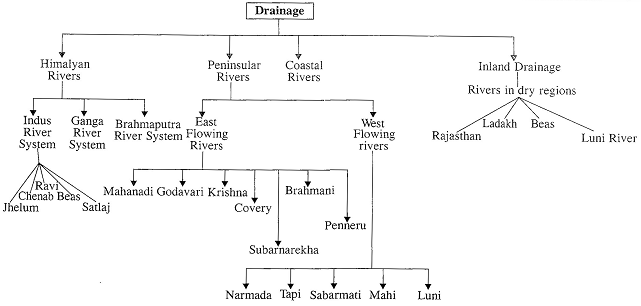
DRAINAGE
The flow of water through well-defined channels is known as Drainage and the network of such channels is called a drainage system. A river drains the water collected from a specific area, is called its catchment Area. An area drained by a river and its tribuaries is called a Drainae Basin. The boundary line separating one drainage basin from the other is known as watershed.
India is drained by numerous rivers falling either into the
Bay of Bengal or the Arabian Sea. The Ganga, Brahmaputra, Mahanadi, Godavari, Krishna and Cauvery are the major river systems draining into the Bay of Bengal, whereas the major river systems draining into the Arabian Sea are the Indus, Sabarmati, Narmada, Tapti and rivers of the west coast farther south. Indian rivers may be classified into four types depending upon the nature of the river, geographical location, source and drainage area covered: Himalayan, peninsular, coastal and rivers of inland drainage basin.
Himalayan Rivers
The Major river systems of the Himalayas Drainage
Indus River System
Jhelum
Chenab
Ravi
Beas
Sutluj
The Ganga River System
|
State |
(%)share |
|
Uttarakhand & UP |
34.2 |
|
MP & Chhattisgarh |
23.1 |
|
Bihar & Jharkhand |
16.7 |
|
Rajasthan |
13.0 |
|
West Bengal |
8.3 |
Ganga
(i) Uttar Pradesh - 1140, (ii) W. Bengal - 520 km,
|
The Ganga Drainage System |
|||
|
Name of the river |
Source |
Length (in km) |
Area drained (sq km) |
|
Ganga |
Gangotri Glacier at 7,010 m |
2,525 |
861,404 |
|
Yamuna |
Yamnotri Glacier at 6,330 |
1,376 |
366,223 |
|
Chambal |
Near Mhow (Indore-M.P) |
1,050 |
139,468 |
|
Ramganga |
Garhwal district at 3,110 m |
596 |
32,493 |
|
Ghaghra |
Near Guria Mandhota peak |
1,080 |
127,950 |
|
Gandak |
South of Manasarovar |
425 in India |
46,300 (7,620 in India) |
|
Kosi |
Tibet-Nepal border at 7,620 Sikkim Nepal- Tibet Himalaya |
730 in India |
86,900 (21,500m India) |
Difference between Delta and Estuary
|
Delta |
Estuary |
|
1. The triangular deposits made by rivers at their mouth form Delta. |
1. The sharp edged mouth of rivers, devoid of any deposits is known as estuary. |
|
2. Deltas are founded in the regions of 100 tides and coastal plains |
2. Regions of high tides and rift valleys witness estuaries. |
|
3. Deltas are fertile lands |
3. Estuary does not have festive lands. |
|
4. Ganga, Brahmaputra, Krishna, Kaveri and Mahanadi rivers form Delta |
4. Narmada and Tapi rivers form estuaries in Western Ghat. |
Yamuna
Chambal
Son
Damodar
Ramganga
Ghaghra
Kali
Gandak
Burhi Gandak
Kosi
The Brahmaputra River System
The Peninsular River System
Three main directions of flow:
The East Flowing Rivers
Mahanadi
Godavari
Krishna
Cauvery (Kaveri)
Subarnarekha
Brahmani
Penneru
The West Flowing Rivers Narmada
Tapi (or Tapti)
Mahi
Luni (or the Salt River)
Inland Drainage
|
Famous Cities and River Banks |
|||||
|
City |
River |
City |
River |
City |
River |
|
Allahabad
|
At the confluence of the Ganga and Yamuna (Sangam) |
Ferozpur |
Satluj |
Mathura |
Yamuna |
|
Guwahati |
Brahmaputra |
Nasik |
Godavari |
||
|
Hardwar |
Ganga |
Patna |
Ganga |
||
|
Agra |
Yamuna |
Hyderabad |
Musi |
Panjim |
Mandavi |
|
Ayodhya |
Saryu |
Jabalpur |
Narmada |
Srinagar |
Jhelum |
|
Ahmedabad |
Sabarmati |
Jamshedpur |
Swamarekha |
Surat |
Tapti |
|
Badrinath |
Alaknanda |
Jaunpur |
Gomti |
Sambalpur |
Mahanadi |
|
Bareilly |
Ram Ganga |
Kanpur |
Ganga |
Serirangapatam |
Cauvery |
|
Cuttack |
Mahandadi |
Kota |
Chambal |
Timchurapalli |
Cauvery |
|
Cumool |
Tungabhadra |
Kolkata |
Hooghly |
Ujjain |
Kshipra |
|
Delhi |
Yamuna |
Lucknow |
Gomti |
Vijayawada |
Krishna |
|
Annual yield of water |
|
|
River |
Contribution (%) |
|
Brahmaputra |
33.8 |
|
Ganga |
25.2 |
|
Godavari |
6.4 |
|
Indus |
4.3 |
|
Mahanadi |
3.6 |
|
Krishna |
3.4 |
|
Narmada |
2.9 |
List of the Projects State, Location and their Purpose
|
S. No. |
Name of the Project |
Location |
State |
Purpose |
|
1 |
Nagarjuna Sagar multi-purpose Project |
River Krishna |
Andhra Pradesh |
Irrigation, Hydroelectncity |
|
2 |
Pochampad Project |
River Godavari |
Andhra Pradesh |
Irrigation |
|
3 |
Lower Sileru Project |
River Sileru (Godavari) |
Andhra Pradesh |
Hydroelectricity |
|
4 |
Kakrapar Project |
River Tapi |
Gujarat |
Irrigation |
|
5 |
Kothagudem Project |
Singareni Coalfields |
Andhra Pradesh |
Thermal power |
|
6 |
Kosi Project |
River Kosi |
Bihar |
Flood Control, Irrigation, Hydroelectricity |
|
7 |
Gandak Project |
River Gandak |
Uttar Pradesh. Bihar |
Irrigation, Hydroetectncity |
|
8 |
Dhuvaran Power Station |
Kheda District |
Gujarat |
Thermal Power |
|
9 |
Sabarigiri (Pamba Kakki) Project |
River Pamba-Kakki |
Kerala |
Hydroelectricity |
|
10 |
Idukki Project |
Rivers Periyar, Cheruthoni, Idukki |
Kerala |
Hydroelectricity |
|
11 |
Chambal Project |
River Chambal |
Rajasthan, Madhya Pradesh |
Irrigation, Hydroelectricity |
|
12 |
Tawa Project |
River Tawa (Narmada) |
Madhya Pradesh |
Irrigation |
|
13 |
Korba Project |
Near Korba Coalfields |
Chhattisgarh |
Thermal Power |
|
14 |
Satpura Power Station |
Patharkada Coalfields |
Madhya Pradesh |
Thermal Power |
|
15 |
Koyna Project |
River Koyna |
Maharashtra |
Hydroelectricity |
|
16 |
Nagpur Power Station |
Koradi, near Nagpur city |
Maharashtra |
Thermal Power |
|
17 |
Tungabhadra Multi-purpose Project |
River Tungabhadra |
Karnataka, Andhra Pradesh |
Irrigation, Hydroelectricity |
|
18 |
Upper Krishna Project |
River Krishna |
Karnataka |
Irrigation |
|
19 |
Sharavathi Project |
River Sharavathi, Near Jog Falls |
Karnataka |
Hydroelectricity |
|
20 |
Hirakund multi-purpose Project |
River Mahanadi |
Odisha |
Irrigation, Hydroelectricity |
|
21 |
Mahanadi Delta Project |
River Mahanadi |
Odisha |
Irrigation |
|
22 |
Bhakra Nangal Multi-purpose Project |
River Sutlej |
Himachal Pradesh, Punjab. Haryana |
Irrigation, Hydroelectricity |
|
23 |
Rajasthan Canal Project |
River Sutlej in Punjab |
Rajasthan, Headworks in Punjab |
Irrigation |
|
24 |
Kundah Project |
River Kundah |
Tamil Nadu |
Hydroelectricity |
|
25 |
Ramganga Multipurpose Project |
Chuisot Stream near Kalagarh |
Uttarakhand |
Irrigation, Hydroelectricity |
|
26 |
Matatila Multipurpose Project |
River Betwa |
Uttar Pradesh. Madhya Pradesh |
Irrigation, Hydroelectricity |
|
27 |
Riband Scheme |
River Rihand |
Uttar Pradesh |
Hydroelectricity |
|
28 |
Damodar Valley Project |
River Damodar |
Jharkhand, Shared with Wpct Rpncral |
Flood Control, Irrigation, I-Tvrlrnplprtrir.itv
|
|
30 |
Mahi Project |
River Mahi |
Gujarat |
Irrigation |
|
31 |
Ghataprabha Project |
River Ghataprabha |
Andhra Pradesh and Karnataka |
Irrigation |
|
32 |
Bhima Project |
River Bhima |
Maharashtra |
Irrigation |
|
33 |
Sardar Sarovar Project |
River Narmada |
Gujarat and Madhya Pradesh |
Irrigation and Hydroelectricity |
|
34 |
Bansagar Project |
River Son |
Madhya Pradesh, Chhattisgarh |
Irrigation |
|
35 |
Dul Hasti Project |
River Chenab |
Jammu and Kashmir |
Hydroelectricity |
|
36 |
Salal Project |
River Chenab |
Jammu and Kashmir |
Hydroelectricity |
|
37 |
Their Dam Project |
River Ravi |
Punjab |
Irrigation, Hydroelectricity |
|
38 |
Malaprabha Project |
River Malaprabha |
Karnataka |
Irrigation |
|
39 |
Jayakwadi Project |
River Godavari |
Maharashtra |
Irrigation |
|
40 |
Beas Project |
River Beas |
Punjab and Haryana |
Hydroelectricity |
|
41 |
Sharda Sahayak |
River Ghaghra |
Uttar Pradesh |
Irrigation |
|
42 |
Mayurakshi Project |
River Mayurkhsi |
West Bengal |
Irrigation, Hydroelectricitv |
|
43 |
Rana Pratap Sagar project |
River Chambal |
Rajasthan |
Hydroelectricity |
|
44 |
Mettur Project |
River Cauvery |
Tamil Nadu |
Hydroelectricity |
|
45 |
Pallivasal Project |
River Munnar Abuja |
Kerala |
Hydroelectricity |
|
46 |
Papanasam Project |
River Thamirabarani |
Tamil Nadu |
Hydroelectricity |
|
47 |
Loktak Project |
Lake Loktak |
Manipur |
Hydroelectricity |
|
48 |
Tehri Project |
River Bhagirathi (Ganga) |
Uttarakhand |
Hydroelectricity |
|
49 |
Farakka Project |
Ganga |
West Bengal |
Irrigation |
|
50 |
Daman Ganga |
River Daman Ganga |
Gujarat |
Irrigation and River Link |
|
51 |
Gima Project |
River Gima (Tributary of Tapi) |
Maharashtra |
Irrigation and River Link |
|
52 |
Pamba Project |
River Pamba |
Kerala |
River Conservation and Irrigation |
|
53 |
Tapovan-Vishnugarh |
River Alaknanda |
Uttarakhand |
Hydroelectricity |
|
54 |
Omkareshwar |
River Narmada |
VIadhya Pradesh |
Hydropower and Irrigation |
Rivers and Disputing States
|
River |
Disputing States |
|
Krishna |
Maharashtra, Andhra Pradesh, Kamataka |
|
Godavari |
Maharashtra, Andhra Pradesh, Madhya Pradesh, Odisha, Kamataka |
|
Cauvery |
Kerala, Kamataka, Tamil Nadu, Puducherry |
|
Narmada |
Rajasthan, Madhya Pradesh, Gujarat, Maharashtra |
|
Mahadayi/mandovi |
Goa and Kamataka |
|
Vansadhara |
Andhra Pradesh and Odisha |
|
Ravi and Beas |
Punjab and Haryana |
|
Mullaperiyar |
Kerala and Tamil Nadu |
Important Falls in India
|
Water Fall |
Height in Meters |
River |
Location |
|
Kunchikal falls |
455 |
Varahi |
Karnataka |
|
Langshiang falls |
337 |
Kynshi |
Meghalaya |
|
Nohkalikai falls |
335 |
- |
Meghalaya |
|
Nohshgithiang |
315 |
- |
Meghalaya |
|
Dudhzagar Fall |
310 |
Mandovi |
Goa |
|
Kynoem falls |
305 |
- |
Meghalaya |
|
Meenmutty falls |
300 |
Karimpuzha |
Kerala |
|
Thalaiyar falls |
297 |
Majjalar |
Tamil Nadu |
|
Barkana falls |
259 |
Sita |
Karnataka |
|
Barchipani falls |
399 |
Budhabalanga |
Orissa |
|
Lakes of India |
|||
|
Wular Lake |
Jammu & Kashmir |
Bhim Tal |
Uttarakhand |
|
Lonar |
Maharashtra |
Sambhar |
Rajasthan |
|
Kolleru |
Andhra Pradesh |
Sukhna |
Chandigarh |
|
Loktak |
Manipur |
Parashuram Kund |
Arunachal Pradesh |
|
Dal Lake |
Jammu & Kashmir |
Pongong Tso |
Jammu & Kashmir |
|
Naini Tal |
Uttarakhand |
Tso Morari |
Jammu & Kashmir |
|
Salt Lake |
Kolkata |
Nakki Lake |
Rajasthan |
|
Chilka |
Odisha |
Pushkar Lake |
Rajasthan |
|
Pulicut |
Andhra Pradesh |
Udaipur Lake |
Rajasthan |
|
Vembanad Kayal |
Kerala |
Upper & Lower Lake |
Bhopal, MP |
|
Ashtamudi |
Kerala |
Nizam Sagar |
Hyderabad |
Main Rivers and their tributaries
|
Rivers |
Left Bank Tributaries |
Right Bank Tributaries |
|
Indus |
Zaskar, Panjnad, Nubra |
Shyok, Gilgit, Kabul |
|
Mahanadi |
Ib, Mand, Hasdo, Sheonath |
Ong, Jonk, Tel |
|
Godavari |
Penganga, Wardha, Wainganga, indravati and Sabari |
Manjira |
|
Krishna |
Bhima, Doni, Musi, Muneru |
Malprabha, Ghatprabha, Tungabhadra |
|
Cauvery |
Herangi, Hemavati, Lokpavani, Srimsha and Arkavati |
Laksmantirtha, Kabani, Suvamavati, Bhavani and Amaravati |
|
Narmada |
Burhner, Banjar, Sher, Shakkar, Towa and Kundi |
Hiran, Bama, Kolar |
|
Tapi |
Sipra, Kapra, Khursi, Mona, Gima, Bori, Amaravati |
Puma, Betui, Patki, Suki, More, Arunavati, Gomai |
|
Ganga |
Gomati, Ghanghara, Gandak, Burhi Gandak and Kosi |
Yamuna, Son, Punpun |
|
Yamuna |
Tons |
Chambal, Sind, Betwa, ken |
Difference between the Himalayan & the peninsular River
|
S. No. |
Aspects |
Himalayan River |
Peninsular River |
|
1 |
Place of Origin |
Himalayan Mountain covered with glaciers |
Peninsular Plateau & Central highland |
|
2 |
Nature |
Perennial |
Seasonal |
|
3 |
Type of Drainage |
Antecedent & consequent leading to dendritic pattern in plains |
Super imposed, rejuvenated resulting in trellis, radial & rectangular patterns |
|
4 |
Basins |
Very large basins |
Relatively smaller basin |
|
5 |
Depth & Valleys |
Rivers form deep vallays & gorges in their source areas |
River valleys are often shallow |
|
6 |
Flow of water |
Cause much erosion & have great flow of water |
Create much less erosion & also have weaken flow of water. |
|
7 |
Irrigation |
Irrigate the northern plains |
Irrigate the Deccan Plateau. |
|
8 |
Stage |
Young & active |
Old rivers with graded profile. |
Longest Rivers Flowing in India
|
River |
Length (km) |
River |
Length (km) |
|
Ganga |
2510 |
Krishna |
1400 |
|
Godavari |
1465 |
Yamuna |
1376 |
|
Sutlej |
1440 |
Narmada |
1289 |


You need to login to perform this action.
You will be redirected in
3 sec

