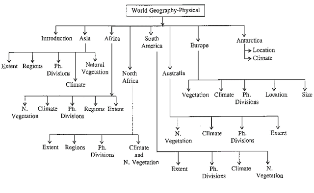
World Geography Physical (Aspect)
INTRODUCTION
In the previous chapters we have discussed the basic elements of Geography which in general deals with nature and scope of Geography, the Universe, the solar system, and its various branches of Geography. In this special branch of Geography we have also discussed development of earth, its lithosphere, hydrosphere and atmosphere in details. Moving on to next important branch of Geography, we are now going to discuss Regional Geography which deals with the studies of the world's regions. In general it is called as World Geography which can be further categorised into three important segments such as physical segment dealing with unique characteristics of earth's relief, their spatial extent, drainage, climate, natural vegetation; social segment that deals with human development, their race and ethnicity and the relationship with their own physical environment; and finally the economic segment which deals with the natural resources, livelihood, transport, communications, etc. Let's start with physical segment.
World Geography Physical
On the basis of major physical characteristics the earth can be divided into large continuous land masses known as Continents and the surrounding water bodies known as Ocean.
Major continents of the world are Asia, Africa, Europe, North America, South America, Antarctica, and Australia.
ASIA
Extent
Asia is the world largest continent, 13 times larger than India having an area of 44,444,100 sq km.
- It covered 30% of the total land surface of the earth latitude: \[{{10}^{0}}\]11’5 to \[81{}^\circ \]12’N. It covers 8.8% of the Earth's total surface area with the population of 4.4 billion which is 60% of the world's total population. It is a continent of contrast in relief, temperature, vegetation and people also. Asia is to the east of the Suez Canal, the Ural River, and the Ural Mountains, and south of the Caucasus Mountains and the Caspian and
- Black Seas. It is bounded on the east by the Pacific Ocean, on the south by the Indian Ocean and on the north by the Arctic Ocean.
Longitude: \[26{}^\circ \]2’E to \[169{}^\circ \]40'W in the east crossing \[180{}^\circ \]longitude
- North -South Extent : 6,440 km
- East-West Extent : 9,650 km
Size: Largest continent of the world.
- The continent of Asia is situated entirely in the northern hemisphere expect some of the island of Indonesia
- It is separated from Europe by the Ural Mountains, the Caspian sea, The Black Sea, the Caucasus Mountains and the strait of Dardanelles in the west and from Africa by the Red sea and the isthmus of Suez while Bering strait it from North America.
- Highest and lowest point: Mt. Everest (8,850) Nepal and Dead Sea Israel/Jordan (392 m below sea level)
Regional Divisions
Asia can be divided into six physiographic divisions:
- Central Asia: Kazakhstan, Kyrgyzstan, Tajikistan, Turkmenistan, Uzbekistan
- Eastern Asia: China, Hong Kong, Japan, North Korea, South Korea, Macau, Mongolia, Taiwan
Northern Asia: Russia
- South-eastern Asia: Brunei, Myanmar, Cambodia, Indonesia, Laos, Malaysia, Philippines, Singapore, Thailand, Timor-Leste, Vietnam.
- Southern Asia: Afghanistan, Bangladesh, Bhutan, India, Maldives, Nepal, Pakistan, Sri Lanka.
5. Western Asia: Armenia, Azerbaijana, Bahrain, Cyprus, Georgia, Iran, Iraq, Israel, Jordan, Kuwait, Lebanon, Oman, State of Palestine, Qatar, Saudi Arabia, Syria, Turkey, United Arab Emirates, Yemen.
Major Physical Divisions
The major physical divisions of Asian continent are:
- The Northern Lowlands
- The Central Mountains
- The Central and Southern Plateaus
- The Peninsulas, the Deserts
- The Great River Plains, the Island Groups
- The Northern Lowlands
The Northern Lowlands are the extensive plain areas which comprise of several patch of lowlands of this large continent. The major lowlands are:
Great Siberian plain
It extends between the Ural Mountains in the west and river Lena in the east. It is the largest lowland in the world covering an area of 1,200,000 square miles approx.
Manchurian Plain
It is the area adjoining Amur river and its tributaries of northern part of China with an area of 135,000 square miles approx. Important cities: Anshan, shenyag and Fushun of Mukden Triangle are located
Great Plains of China
It is contributed by two major rivers of China, Hwang Ho and Yangtze river eastern China which covers an area of 158,000 square miles approx.
Tigris - Euphrates Plain:
These region formed by the two river viz, Tigris and Euphrates Historically, the Area is known as Mesopotamia. Iraq is dominated by these rivers and shares boundary with Kuwait Saudi Arabia, Jordan, Syria, Turkey and Iran.
- The Central Mountains
These are the prominent and extensive mountain ranges which covers the parts of Central Asia. They consist of Pamir and Tian Shan ranges, and extending across portions of Afghanistan, China, Kazakhstan, Kyrgyzstan, Tajikistan, and Uzbekistan. These mountain ranges are designated as biodiversity hot spot by Conservation International which covers several montane and alpine ecoregions of Central Asia. It encompasses several habitat types, including montane grasslands and shrublands, temperate coniferous forests, and alpine tundra.
Important Mountains
Himalayan Range
- An example of young fold mountain
- Lies to the North of Indo-Gangetic Plain
- Mount Everest (8,850 m) is the highest peak of world located in Nepal
Karakoram Range
- Lies to the North of Himalaya.
- Karakoram separates the states of Kashmir from china.
- The world's second highest peak K2 (8611 m) is within this range.
- World famous glaciers, the Siachen glaciers is also located in the range.
Kailash Range
- East of Karakoram Range
- It is located is Tibet
Teinshan
- Lies to the north of Tarim basin
Great Kingan Mountain
- Tien shan extends to the North east and reaches the Amur River under the name of Great Khingan Mountains.
Altai Mountain
- Lies to the north of Tienshan in succession in a more or less east-west direction
Verkhoyansk Range
- Lies to the east of the lena River separates central Siberian Plateau from the eastern siberiam region.
Pegu yoma
- Irrawaddy and sittang are divided in their middle course by the this mountain range.
Arakan Yoma
- A range of Himalaya
- Running south words, is the western range of Myanmar
A mountain knot is a junction of two or more mountain ranges. The two main mountain knots in Asia are:
- The Pamir Knot is the junction of five mountain ranges they are the Sulaiman, the Hindu Kush, the Kunlun, the Karakoram and the Himalayan ranges. Mount Everest, the highest peak in the world in the Himalayan range.
- The Armenian Knot is connected to the Pamir Knot by the Elburz and the Zagros Ranges that originate in the Armenian Knot. The Tien Shan and the Altai are other mountain ranges in Asia.
- The Central and Southern Plateaus
Plateaus are the land areas having a relatively that surface considerably raised above adjoining land on at least one side, and often cut by deep canyon.
|
Plateau
|
Location
|
Types
|
|
Ladakh
|
Between Karakoram and Himalaya mountain ranges
|
Intermontane
|
|
Tibet
|
Between Kulun and Himalayan Mountain range
|
Intermontane
|
|
Yunan
|
Situated on the south east of the Tibet Plateau and separated from Szechuan Basin extensive fertile land by the range of Mountains
|
Piedmont
|
|
Pamir
|
Well connected to the range of mountains such as Himalayas with the Tian Shan, Karakoram, Kunlun, and Hindu Kush ranges on all sides
|
Intermontane
|
|
Armenian
|
Present in between Capian and Black Sea
|
Piedmont
|
|
Iranian
|
Present in between Zagros Mountains, Caspian Sea, Turkmen-Khorasan Mountain Range
|
Piedmont
|
|
Mongolian
|
Surrounded by the Greater Hinggan Mountains to the east, the Altai Mountains to the West, and the Sayan and Khentii Mountains to the north
|
Intermontane
|
|
Shan
|
Stretched in between the pegu Yoma and Arkan Yoma in the Eastern part of Myanmar.
|
Intermontane
|
|
Deccan
|
Extended in between the Western Ghats in west and the Eastern Ghats in the east of Indian Subcontinent , it almost touches the southern tip of India and in north covered by the Satpura and Vindhya Ranges
|
Intermontane
|
|
Anatoilan
|
Enclosed betweet Pontic Mountain ranges in the South and Taurus in the south West
|
Volcanic
|
|
Shan Plateau
|
Lies between pegu yoma and Arkan yoma in eastern part of Myanmar
|
Intermontane
|
|
Arbian Plateau
|
Extending over the entire Arabian Peninsula
|
Tilted Block
|
|
Loess Plateau
|
Plateau region is surrounded by great plan in the cast Qining Mountains in the south and ordos plateau in the north
|
Wind bone fine dust
|
- Peninsulas Deserts
A peninsula is a mass of land surrounded by water, but attached to the mainland. The Deccan plateau region is also a peninsula. The major peninsulas of Arabia, India and Malay are in southern Asia. The Kamchatka peninsula lies in north-eastern Asia.
Big Deserts of Asia
- Gobi desert - Mongolia
- Takia makan - China
- Rub-al-khali - Saudi Arabia
- Al Nafud Desert- Saudi Arabia
- Dasht-I-Kavir-Iran
- Dasht-I-Lut-Iran
- Thar-India
- (a) Islands of Asia
Asia also has a cluster of islands, also called an archipelago. An archipelago sometimes called an island group or island chain, which are formed close to each other in large clusters. Indonesia, Philippines, Japan, Andaman and Nicobar are some examples of archipelagos.
(b) Drainage of Asia
The drainage of Asia consists of mighty oceans, extensive seas, lengthy rivers and their tributaries and distributaries, major lakes, etc.
Oceans: Asian continent is surrounded by three major ocean from three sides such as
It covers the eastern part of Asia where major rivers of eastern Asia drain, such as Menam Mekong, Xi Jiang, Chang Xiang, Huang Ho and Amur.
It covers the southern part of Asia and the major rivers flow into Indian Ocean are Tigris, Euprates, the Indus, the Ganga, Brahmaputra, Irrawaddy, Salween.
It covers the Noth east part of Asia and consists of three major rivers such as Ob, Yenisey and Lena.
Seas
As the continent is covered by sea from its three sides, It has also characterised by long stretch of bay and gulf. Major seas contributing Asian Drainage are Sea of Galilee, Andaman Sea, Arabian Sea, Banda Sea, Barents Sea, Bering Sea, Black Sea, Caspian Sea, East Siberian Sea, Java Sea, Kara Sea, Laccadive Sea, Sea of Japan, Sea of Okhotsk. South China Sea and Yellow Sea.
Lakes
Major lakes of Asia are Lake Baikal, Onega, Ladoga, and Peipus in Russia; Lake Akan, Mashu, Biwa, Shikotsu in Japan; Qinghai Lake, Lake Khanka in China; Dal Lake, Chilka, Vembanada, Pullicat and Sukhna in India; Lake Matano and Toba in Indonesia,
- Lake van Golu in Turkey,
- Lake Turnool in Turkey,
- Lake Asad in Syria
- Dead sea in Jordan/Israel.
Climate
As a land of Contrast Asia is characterized by varied climatic type on the basis of the temperature and rainfall condition. The rainfall across the continent is highly influenced by Monsoon winds the Asia can be divided into three major climatic zones such as:
Monsoon Climate
The Monsoon Asia is the zone including south and south East Asia and East Asia where the effect of monsoon is prominent. Hence the climatic condition varies according to monsoonal wind flow. After the onset the wind starts moving in the North West direction, hence causing rain over the eastern coast of Indian subcontinent, and parts of south east and East Asia. Moreover the summer spell in India is very hot and dry which trigger the occurrence of additional heavy precipitation owing to tropical cyclones. Monsoonal climate is best developed in the Indian subcontinent, South East Asian countries, Southern china (Asia) and Northern Australia. In winters the central land mass of Asia gets cool more rapidly than the surrounding ocean. This climatic phenomenon starts the flow of cold descending air current in the central Asia which results into generation of high pressure in the heart of Asia. The high pressure starts chasing the low pressure zone present over Indian and Pacific Ocean due to comparatively high temperature. This is called as retreating monsoon or season of winter monsoon. As a result of these phenomena of both onset and retreat of monsoon there is marked difference in the climate of Northern and Southern part of Asia.
Dry Climate
The Dry Asia consists of South West Asia, Central Asia and
Mongolia Latitudinally it varies from tropical desert of Arabian Peninsular to subtropical steppe in Afghanistan and further to mid latitude steppe and desert of Mongolia and Northern China. As compared to other parts of the continent the rainfall is also very less, i.e. 2.5 cms to 20 cms and it is very unpredictable throughout the region. Moreover a Mediterannean climate is experienced over the coastal region which receives winter rainfall.
Cold Climate
The Cold Asia is experienced in maximum part of Russia as an influence of sub-arctic climate. The summer is comparatively mild and lasts for only for four month. The rainfall is also less as compared to other parts of the continent. The annual rainfall accounts for only 50 cms in the coastal areas whereas towards interior, it decreases up to 25 cms.
Natural Vegetation
There are various types of vegetation found in Asia. For
Examples:
Tundra
The Tundra extends to\[{{70}^{0}}\]N and with further south extensions on high altitudes (Chersk, Verkhoyansk and Kamachatka mountains). The region is covered by cold, treeless plains with permanently frozen subsoil.
Vegetation species -Mosses, Lichens, sledges and wild flowering shrubs occur in patches.
The Taiga
The Taiga found in south of tundra is a belt of coniferous forests running across whole of Siberia from west to east reaching Pacific and northern part of Japan. The trees have small leaves, deep roots and thick bark.
Vegetation species
Here, the richest source of softwood occurs in pure strands with a few species four major species of Taiga are pine, fir, spruce and larch.
Almost all trees are evergreen and conical in shape with small, thick needle shaped leaves.
Temperate Grasslands
These are elongated, unbroken stretch of the Steppes from
Ukraine to Manchuria, which further stretches to several thousand miles in southern Siberia. Region gets low precipitation although cold winters with warm summer. High elevated mountains here are covered with forests.
Vegetation species
Valuable temperate hardwood species are oak, elm, poplar, beech and willow. They are excellent for both fuel and industrial purposes.
Mediterranean Scrubland is an area of dry land with small bushes and trees
In this region summers are hot and dry; the winters mild and moist. Vegetation species, vegetations grown here are of small size, short leaves, deep roots, and thick barks to retain moisture. It includes countries of Israel, Lebanon, Syria, Iraq, and the plateaus of Turkey and Iran.
Desert Vegetation
Desert Vegetation types are found in the Arabian Peninsula, the deserts of Tibet, Mongolia, and the desert-like steppe-lands bordering the Caspian Sea. Vegetation species the region is sparsely populated by vegetation. Moisture-combating plants, waxy, deep-rooted or thorny shrubs and sporadic stunted trees grow here.
Monsoon Vegetation
Monsoon Region vegetation varies with the amount of annual rainfall each year in this region. The average range of rainfall varies between 40 inches and 80 inches annually. Mostly, tropical deciduous (shedding leaves seasonally) forests, and those which receive less than 40 inches have savanna and steppe-like vegetation are seen. The monsoon lands have been extensively modified by human settlement and put to cultivation, and little trace of the original vegetation survives.
Vegetation species
Here, forests have fewer species like teak, sal, sandal wood, bamboo of which teak is a valuable hardwood.
Tropical Rainforest
Tropical Rainforest is the region where evergreen, broad- leafed tall and high-crowned trees are found in this region. Several species having a dense canopy above the floor due to the heavy rainfall received all round the year. The savannas and deciduous trees cover the ground, the subequatorial and the areas that lie in the rain shadow on the leeward slopes. Malaysia and Indonesia, southern Sri Lanka and Java have vegetation species. Plantation tea, rubber, coffee, cocoa, etc. are found here.
Mountainous Vegetation
Vegetation in the Mountain area is found on southern and eastern Asia. The higher elevated part is snow covered by meadows. Lower parts are covered by broad-leafed deciduous forests, and on higher ground the coniferous trees occur.
Peaks of Asia
· Mount Everest (1885 m), Nepal-Tibet, China border
· K2 (8, 61, 1 m), Pakistan-China
· Kangchenjunga (8,586 m), Nepal-Sikkim (India).
· Lhotse (8,516 m), Nepal-Tibet, China
· Makalu (8,462 m), Nepal-Tibet, China
· Cho Oyu (8,201 m), Nepal-Tibet, China
· Dhaulagiri (8,167 m), Nepal
AFRICA
Extent
Latitude: \[37{}^\circ \]31’to \[34{}^\circ \] 52’S
Longitude: \[25{}^\circ \]11’ w to \[51{}^\circ \]24’ E
Size: Second largest continent after Asia and nine times the size of India.
North South Extent - 7623 km
East-West Extent - 7260 km
Africa is the second largest continent in area (30,330,000 sq. Km) which covers 6% of Earth's total surface area and 20.4 % of its total land area. Algeria is Africa's largest country by area, and Nigeria by population. Separated from Europe by; the Mediterranean Sea, it is joined with Asia at its northeast extreme end by the Isthmus of Suez 163 Km wide. It is bounded by Red Sea along the Sinai Peninsula to the northeast, the; Indian Ocean to the southeast, and the Atlantic Ocean to the west. With fully recognized 54 sovereign states, nine territories and two de facto independent states.
Africa belong to all four hemisphere and bulk of the continents lies in tropics. It is only continent which is crossed by tropic of cancer, Equator and Tropic of Capricorn.
Regional Divisions
The physiographic divisions of Africa are into the following six regions:
Northern Africa
It extends from Algeria in the north, through, Canary Islands, Santa Cruz de Tenerife, Ceuta, Egypt, Libya, Madeira Melilla, Morocco, Sudan and Tunisia. It reaches upto Western Sahara.
Northeast Africa
It is also called the horn of Africa which extends several
Hundred kilometers into the Arabian Sea and lies along the southern side of the Gulf of Aden. It contains countries such as Djibouti, Eritrea, Ethiopia, and Somalia.
Eastern Africa
The extensive area stretches from Red Sea and horn of Africa to Mozambique including Burundi, Comoros, Kenya, Madagascar, Malawi, Mauritius, Mayotte, Mozambique, Reunion, Rwanda, Seychelles, South Sudan, Tanzania, Uganda, Zambia, Zimbabwe.
Central Africa
It is the large land mass situated exactly in the middle of the continent covering Angola, Cameroon, Central African
Republic, Chad, Republic of the Congo, Democratic Republic of the Congo, Equatorial Guinea, Gabon, Sao Tome and Principe.
Southern Africa
It is the southernmost part of the continent and covers the countries such as Botswana, Lesotho, Namibia, South Africa, and Swaziland.
Western Africa
It is situated roughly at 100° E longitude covering countries like Benin, Burkina Faso, Cape Verde, Gambia, Guinea, Guinea-Bissau, Ivory Coast, Liberia, Mali, Mauritania, Niger, Nigeria, Saint Helena, Senegal, Sierra Leone and Togo.
Major Physical Divisions
The major physical divisions of African continent are:
The Plateau
The Fold Mountains
Deserts
Islands
Rivers
The Plateaus
The vast African continents are famous for its saucer shaped and steep edged plateaus which are facing towards the coast and extending from Guinea coast to Somali Land and north Sahara to the Cape Province. These are divided into three groups:
South African plateau
- The South African plateau as far as about 12°S, bounded east, west and south by bands of high ground which fall steeply to the coasts. The South African plateau is connected towards the north-east with the East African plateau.
- Drakensberg scarpland is Ingh escrapement in south-east Africa caused by lana flow. It is an example of continental plateau.
East African plateau
- The East African plateau, with probably a slightly greater average elevation, and marked by some distinct features. It is formed by a widening out of the eastern axis of high ground, which becomes subdivided into a number of zones running north and south and consisting in turn of ranges, tablelands and depressions.
Ethiopian Highlands (volcanic origin)
- The third division of the higher region of Africa is formed by the Ethiopian Highlands, a rugged mass of mountains forming the largest continuous area of its altitude in the whole continent.
- Ras Dashan (4, 620 m) is the highest peak of Ethiopian highland and third highest peak of Africa. The high plateau is the source of Blue Nile River.
The Fold Mountains
Africa is famous for its newly formed folded mountains.
Prominent mountain ranges with some of the very high raised mountain peaks are the specialty of African Continents. Some of the well-known mountain ranges are:
Atlas Mountains
- It is situated on the north western part of the continent stretching over an area of 2400 km towards the south west direction across Morocco, Algeria and Tunisia.
The range is divided into five separate ranges running parallel to each other:-
(i) High (Hant) Atlas MTS
(ii) Anti-Atlas
(iii) Middle Atlas
(iv) Sahara Atlas
(v) Maritime Atlas
- These mountains sweep across the center from north-east to south-west and rising 2,750 m in the Middle Atlas to cover 4,000 m in the high Atlas and to the south the Ami Atlas (The uplifted edge of the Saharan platform) reaches 2,000 m. The Jebel Toubkal is among such highlands or mountain whose height is 4165 m from sea level.
- It is a physical separator between the extensive coasts of Mediterranean and Atlantic Sea and the Sahara Desert.
Ruwenzori Mountains
- Stretching over an area of 240 sq. miles the range borders Uganda and Congo (Kinshasa) and thought to be the
“Mountains of the Moon.
- Mount Stanley at Margherita Peak (5,109 m) is the highest pick of this mountain system.
- It is a gigantic horst of six separate glaciated masses which falls steeply westward to the Western Rift Valley.
- It is situated near lake Mobutu or lake Albert in zaire.
Mount Elgon
- It is an extinct volcanic mountain situated at the north east part of lake Victoria on the Uganda - Kenya border.
- The height is about 4,321 km from the mean sea level.
- As a volcanic mountain it has a crater which is 610 m deep and 8 km across.
The Tibesti Mountains
- These are mostly situated in the northern part of Chad and spread west into northern Niger and the Southern border area of Libya.
- Desert Mountain
- The highest peak is 3,415 m. from mean sea level.
Ahaggar Mountains
- The Ahaggar Mountains, also known as the Hoggar, are a highland region in central Sahara, or southern Algeria near the Tropic of Cancer. They are located about 1,500 km south of the capital, Algiers. Mount Tahat is the highest peak
(2, 918m).
The Drakensberg
These mountains are the highest in Southern Africa rising up at Thabana Ntlenyana at 3,482 m (11,422 ft) in height. They are located in the eastern part of South Africa, running from some 1,000 km. The highest peak is Thabana Ntlenyana at 3,482 m (11,422 ft). It is also the highest peak of Lesotho.
Mount Kenya
Mount Kenya is the highest mountain in Kenya, and the second highest in Africa (after Mount Kilimanjaro). The highest peaks of the mountain are Batian (5,199m - 17,058 ft), Nelion (5, 188m - 17,022 ft) and Lenana (4,958 - 16,355 ft). Mount Kenya is located in central Kenya, just south of the equator, around 150 km (95 miles) north-northeast of Nairobi. Volcanic in origin.
Kilimanjaro
- It is also known as Mount kibo
- An example of extinct volcanoes.
- Coffee is grown on the slopes of kilimanjaro.
Kilimanjaro with its three volcanic cones, Kibo, Mawensi and Shira, is an inactive stratovolcano in north-eastern Tanzania. Kilimanjaro is the tallest free-standing mountain rise in the world rising 4,600 m (15,100 ft.) from its base, and includes the highest peak in Africa at 5,895 meters (19,340 ft).
The Deserts
- Lies between 15 ° to 30° latitudes
- The Sahara, the largest hot desert in the world, stretches across the entire width of North Africa. It covers an area of approx. 3,320,000 sq. miles.
- Erg Sandy desert of Sahara (9.1. sq. km) is undulating plam of sand, produced by wind deposition
- Hamada Rocky desert of Sahara is bare rock surface formed by defcation. The major countries contributing their lead to Sahara deserts are Libya, Algeria, Egypt, Tunisia, Chad, Morocco, Eritea, Niger, Mauritania, Mali and Sudan.
- The Kalahari Desert lies in the south and the Namib Desert is along the south-west shore of Africa. It covers an area of 3,50,000 sq. miles and eneroachig parts of Botswana, Namibia, Zambia, Angola and Zimbabwe.
Home of one of the African's oldest races, the Kalahari bushme
- The Nubian Desert is the eastern region of the Sahara desert, between the Nile and the Red Sea. There is virtually no rainfall here, and there are no oases. It is in Egypt. It covers an area of 1,54,000 sq. miles aporox.
Karoo: The Karoo is a semi-desert region of South Africa. It has two main sub-regions - The Great Karoo in the north and the Little Karoo in the south. The Great Karoo has an area of more than 400,000 sq. Km. Currently sheep farming is the economic backbone of the Karoo, with other forms of agriculture established in areas where irrigation is possible. Lately game farms and tourism have also started to make an economic impact. The Little Karoo is the smaller (and more southerly) of the two Karoo sub-regions. Locally, it is usually called the Klein Karoo Geographically it is a fertile valley.
The Islands
- There are very few islands near Africa.
- Madagascar (Malagasay) in the Indian Ocean is the largest island in Africa.
- To the north-west, in the Atlantic Ocean are the Canary Islands.
- West of Africa in the South Atlantic Ocean is the island of Saint Helena where Napoleon died in exile.
- Zanzibar belongs to Tanzania and is closer to the Indian Ocean.
THE RIVERS OF AFRICA
The most important ones are the Nile, the Congo, the Niger and the Zambezi.
River Nil
- This is the longest river in the world.
- It starts from many streams in the equatorial rainforest of the Lake Victoria and Ruwenzori Mountain (the mountains of the moon) region.
- From Lake Albert, it flows as the White Nile.
- At Khartoum, it is joined by the Blue Nile which starts from Lake Tana on the Ethiopian Highlands.
- The Nile flows from 3,000 kilometres through the dry Sahara Desert of Egypt and enters the Mediterranean Sea.
- Egypt is called the gift of the Nile because without the river it would have been a desert.
Dams on Nile
(i) Owen Dam near the owen falls, on the white Nile, where it leaves lake victoria
(ii) Sennar Dam on Blue Nile in sudan
(iii) Aswan Dam on the Nile in Egypt - control the flow of the great river,
River Congo or Zaire
- The Congo is the second longest river of Africa.
- It starts from the south-west of Lake Tanganyika and flows into the Atlantic Ocean.
- The Zaire basin is one of the wettest regions of the Earth and is covered with dense impenetrable jungle.
- The river and its network of tributaries are not navigable because of rapids and waterfalls caused by the descent from the plateau to the coast.
- It cut equator twice.
- The kasai and oubangi are the main tributaries of zaire
- Stanley fall and living stone fall are on the zaire river
- Inga Dam is located on the zaire River.
River Niger
- This river is the chief river of West Africa.
- The third longest river in Africa
- Port Harcourt of Nigeria is Located on the Niger Delta.
- It rises from the Fouta Djllon Mountain quite close to the sea but flows north and then turns south again to form a wide arc.
- Finally it joins the Gulf of Guinea on the Atlantic Ocean.
River Zambezi
- River Zambezi flows into the Indian Ocean.
- The famous Victoria Falls at the head of a long gorge is on this river.
- It is also a natural political boundary between Zambia and Zimbabwe.
River Limpopo
- River Limpopo also flows into the Indian Oceans, which crosses the Tropic of Capricorn twice.
- Limpopo River Separated south Africa from Botswana and Zimbabwe.
River Orange
- This flows from the Drakensberg Mountains into the Atlantic Ocean.
- Orange River forms a natural boundary between South Africa and Namibia.
RIFT VALLEY OF AFRICA It streches, north words throught zambia, Malawi (L.Nayasa), Tanzania (L.Tanganyika), Kenya and Ethiopia and extends along the red sea to Israll and Jordan for about 5,000 Km
The Lakes of Africa
- Lake victoria is the world's third largest lake ofter Caspian sea and lake superior.
- North America largest fresh water lake in the world. It is the largest lake of Africa. It is situated on the block mountain between the two branches of the Great Rift Valley. The Equator passes through it. It is the source of white Nile.
- The lakes of the rift valley. There is a string of lakes in the rift valley. Lake Tanganyika and Lake Nyasa (Malawi) are the larger ones.
- Lake Tana is on the Ethiopian Plateau. It is the source of Blue Nile.
- Lake Chad at the southern edge in the Sahara Desert is in a region of inland drainage. Streams start from the sur- rounding hills and flow into this lake instead of the sea. River Charl is the largest river of this area.
- Lake Nasser is on river Nile. It is a man-made lake located between Egypt and Sudan
- Lake Kariba is situated on the southernmost part of Africa an Zambezi river. It is one. of the biggest look man-made like and it is the largest producer of hydroelectricity in Africa.
- Lake Assal is situated in Djibouti and the lowest point in Africa
Famous Lakes of Africa
|
Lake
|
Elevation
|
Lake Type
|
|
Victoria
|
11.33m
|
Tropical Lake
|
|
Tanganyika
|
2500m
|
Rift Valley Lake
|
|
Malawi
|
-
|
African Rift Valley
|
|
Turkana
|
360m
|
Alkaline Lake
|
|
Lake Albert
|
615m
|
Western Rift
|
|
Lake Edward
|
912m
|
Drain North into Lake Albert
|
|
Lake Kivu
|
1460m
|
Ruzizi River
|
Important Dams and Waterfalls
|
Dam/Falls
|
River
|
Country
|
|
Aswan Dam
|
Nile
|
Egypt
|
|
Kariba Dam
|
Zambezi
|
Zimbabwe and Zambia
|
|
Kainji Dam
|
Niger
|
Nigeria
|
|
Cobora Bassa Dam
|
Zambezi
|
Mozambique
|
|
Victoria Fall
|
Zambezi
|
Zambia- Zimbabwe
|
|
Boyoma Fall
|
Zaire
|
Democratic
|
|
|
|
Republic of Congo
|
Climate
It is quite obvious that as a large continent Africa experiences a highly variable climate. Keeping in view the prevailing weather conditions such as temperature, rainfall, humidity etc the climatic zones of Africa are:
Tropical Monsoon Climate
- It is associated with high mean annual rain fall and temperature, average annual temperature is 27.\[{{05}^{0}}\]C and the Annual average rainfall vary from 50-150 cm.
- Mostly the central of Africa and eastern cost of Madagascar experience this type of Climate such as Lagos, Kinshasa, Abidjan, Dar es Salaam and Ibadan.
- The hot Summer is generally due to the nearness of equator as the zone is present \[10{}^\circ \] to 20° on either side of the equator and it brings good amount of rainfall to this region.
Humid and Sub humid tropical climate
- This type of climate is characterised by hot, usually humid summers and mild to cool winters. Although the temperature is relatively high but the rain fall is evenly distributed.
- The average annual temperature varies between \[-30{}^\circ \]C \[180{}^\circ \]C in the coolest month whereas it is above \[220{}^\circ \]c in the warmest month.
- The climate occupies comparatively a large part of African continent like Kwa Zulu-Natal and the Eastern Cape provinces of South Africa, north eastern Zimbabwe, Niassa, Manica and Tete provinces of Mozambique, southern Congo provinces, Malawi, and Zambia. Ethiopian Highlands.
Mediterranean Hot Summer:
- This type of climate is associated with high temperature and they generally get precipitation during autumn, winter and spring.
- The temperature reaches to \[48\text{ }{}^\circ \]c in summer and the rainfall is almost nil during this period of 4-6 months.
- The winter is also mild as the rainfall is scanty.
- This type of climate is more common around the
- Mediterranean Sea, southwestern Australia, southwestern South Africa, sections of Central Asia, the Rogue River Valley region of southwestern Oregon, and in the interior of northern California west of the Sierra Nevada.
Hot Desert Climate;
- It is typically a very hot and dry zone where the temperature ranges between \[40{}^\circ \] C to \[45{}^\circ \] C throughout the year.
- They are more common in the deserts of North Africa such as the wide Sahara Desert, the Libyan Desert or the Nubian Desert; deserts of the Horn of Africa such as the Danakil Desert or the Grand Bara Desert; deserts of Southern Africa such as the Namib Desert or the Kalahari Desert.
Tropical Wet/Dry (Savanna) Climate
- This is a typical climate experienced in-between \[5{}^\circ \text{ }-10{}^\circ \] and \[15{}^\circ \]C to \[20{}^\circ \]C in both the latitude.
- Spatially they are found north and south central part of Africa, Campos of Brazil.
- Diurnal temperature ranges of \[10{}^\circ \]C to \[15{}^\circ \]C during winter are not uncommon.
The Summers are hot and humid which provide an uncomfortable living environment.
Natural Vegetation
There are extensive areas in Africa where few people live and where natural vegetation and wild animals have not been disrupted by such activities as farming or the raising of livestock. In some parts of the continent large forest reserves have been established, like.
Tropical Rain Forests
Large area of Africa is covered by tropical rain forests, or selvas type of vegetation covering less than a tenth of the continent with heavy rain throughout the year. These forests contain several layers of vegetation. The top layer consists of the crowns of trees rising 125 to 250 feet (38 to 76 m) in height; the lower layers are arranged according to their height like shorter trees, shrubs, and vines respectively. Most of the trees are broad-leaved evergreens, along with few conifers ones. They yield pulp, timber, and such cabinet woods as mahogany, ebony, and teak. Oil palms, rubber- producing trees and vines, orchids, and lilies are among the numerous kinds of plants found in these forests.
Tropical Savannas
- Savannas, covering perhaps one third of the continent, consist of areas mainly growing grass.
- There are spots of woodlands, scattered trees, or shrubs, depending on the length of the dry season.
- Coarse grasses upto 12 feet (3.7 m) high and large woodlands of deciduous trees are found near the border of Tropical forest.
- They even include many evergreens found in tropical rain forests, such as oil palms, rubber trees, and African ebony trees.
- There are also shea trees (whose seeds yield an edible fat), baobabs, flat-topped acacias, kapok, and many trees that bear edible fruit.
- As the dry season becomes pronounced grass grows shorter rarely reaching the height of five feet (1.5 m) high. Palms, baobabs, acacias, and such brightly flowering trees as cassias and erythrinas grow in small clumps or are scattered singly over the grassy areas.
- Away from the Equator to the north and south, rainfall decreases and there is a zone where there is a definite dry season unlike the equatorial region where it rains always.
- This is the Sudan type of climate and has tropical Grassland or Savanna vegetation.
- This region continues over the Eastern Highlands and forms a wide area around the equatorial forests.
- The grass is thick and coarse. In some places there is the tall elephant grass.
Tropical Steppes and Deserts
Increased aridity and longer dry seasons are the main features of tropical steppes. These are regions grow short grasses only. Thorny acacias, euphorbias, dwarf palms, and jujube trees are found here.
- Steppes bordering on deserts no trees are spotted, rather widely scattered bunches of grasses grow.
- Rain here brings flowering plants and variety of grasses springs up and thrives.
- True deserts, of the Sahara and the Namib, are virtually featured with no vegetation except at oases (places watered by springs or wells).
- Vegetation at oases includes date palms, fig trees, willows, poplars, and tamarisks.
Mediterranean Forests
- Mediterranean type of vegetation in Africa is found along the northern and southern coast.
- Different variety of shrubs and small trees, both deciduous and evergreen are grown.
- The plants are able to withstand long, dry summers with waxy, leathery leaves and long taproots develop here.
- The northern region raises cork oak, olive trees, cedars, and pines; in the south, laurels, cedars, and ironwood. Grasses and low flowering plants grow only during the rainy months.
Montane Forests
- African vegetation system has localized characters. The Montane vegetation of highlands, particularly in Ethiopia and the mountains of the Great Rift Valley are such example.
- Depending on elevation, latitude, and direction of the winds vegetation grows.
- The region under Montane forests yield valuable timber and cabinet woods along with bamboo and wild varieties of coffee and banana.
- The slopes of mountain are covered with thick evergreen forest.
- At higher elevations, grasses and colorful, low-growing plants are typical. The High Veld of South Africa is temperate grassland between 3,500 and 11,000 feet (1,070 and 3,350 m) above sea level.
Mangrove Forests
- Mostly found along the African coast, but are most extensive along the Gulf of Guinea.
- A variety of other trees tailored to life in muddy estuaries and tidal flats are found other than Mangrove.
- Swamp and marsh also occur along the larger rivers and lakes of western and central Africa.
- Papyrus, tall grasses, and lotus are the most common plants.
- The Sudd region of the White Nile River is one of the largest marshes in the -world.
NORTH AMERICA
Extent
Latitude: \[7{}^\circ \]12'N to \[{{83}^{0}}\] 38’ N
Longitude: \[12{}^\circ \]08’ W to \[172{}^\circ \] 30’W
North America is surrounded by the Atlantic ocean in the east, gulf of Mexico in the south, the pacific ocean in the west and the Arctic ocean in the North To the north it is Separated from the eastern most tip of Siberia by the bering strait. North America is the third largest continent after Asia and Africa, It covers an area of nearly 24 million square kilometers.
In other words, its northern boundary is only about 500 kilometers away from the North Pole and its western boundary only 10 kilometres away from the International Date Line.
There are five time zones in North America.
The Tropic of Cancer and the Arctic Circle pass through the continent and the 100°W longitude cuts through the centre of the continent.
\[{{49}^{0}}\]N latitude forms the boundary between canada and U.S. A This huge landmass includes three large countries - Canada, United States of America and Mexico, seven small states of Central America and the islands of the West Indies.
The Atlantic, Pacific and Arctic oceans surround North America in the east, west and north respectively.
In the north-west the Bering Strait separates it from Asia and in the south-east the Isthmus of Panama joins it to South America.
North America has a smooth coastline except for the existing in the north-west. Fiord (fiord) is a long, narrow winding inlet from the sea between steep slopes of a mountainous coast. It usually occurs where ocean water flows into valleys near the coast by glaciers.
Regional Divisions
Region wise North America can be classified into 5 parts which are listed below:
Western Region
Young mountains rise in the west. The most familiar of these mountains are probably the Rockies, North America's largest chain. They stretch from the province of British Columbia, Canada, to the U.S. state of New Mexico.
Great Plains
In the middle of the continent lies the Great Plain. Deep, rich soil blankets is large areas of the plains in Canada and the United States. Grain grown in this region, called the “Breadbasket of North America,” feeds a large part of the world. The Great Plains are also home to rich deposits of oil and natural gas.
Canadian Shield
The Canadian Shield is a raised but relatively flat plateau. It extends over eastern, central, and northwestern Canada. The Canadian Shield is characterized by a rocky landscape pocked by an astounding number of lakes.
Eastern Region
This varied region includes the Appalachian Mountains and the Atlantic coastal plain. North America's older mountain ranges, including the Appalachians, rise near the east coast of the United States and Canada. These areas have been mined for rich deposits of coal and other minerals for hundreds of years.
Physical Division
North America can be divided into three physical regions:
- The Western Cordilleras
- The Central Lowlands
- The Eastern Highlands
The Western Cordilleras
They are made of three almost parallel ranges, running north to south.
(i) Coast Mountains
- Mount logan (6050 m) in the yukon Territory (conada) is the second highest peak of North America.
(ii) (a) Cascode Range
- East of coast Mountain, running from North California to Washington
- (b) Sierra Nevada
- From south of cascode Range to Southern California along the pacific coast.
(iii) Rocky Mountains
|
Brook's Range
• Located in Alaska (U.S.A)
• Extends in the East-West direction
• It is a continuation of the Rockies
Alaska and Aleutian Ranges
• This ranges terminate in the Aleut an islands
• Part of Pacific Mountain system
• Mount Mckinley (6194 m) is the highest peak of north America is in the Alaska Range
|
|
• Aniakchak in Alaska (Active volcanoes)
• Popocatepetl in Mexico (Active volcanoes)
• Sa Andcas jault (surface transform fault)
|
- Rocky Mountains lies east of the Cascade Range and sierra nevada, running from Alaska to Mexico and is over 4000 m.
- The parallel ranges of young fold mountains run from Alaska and extend into South America as the Andes.
- As they resemble twisted cords they are known as Cordilleras.
- Fold mountains are formed when tectonic plates push the Earth’s crust and force it to form ridges and valleys.
- Volcanic rocks form the base of fold mountains.
- The Cordilleras are part of the Pacific Ring of Fire. Mount St. Helena is in the USA.
- The snow-covered Cordilleras act as a barrier to moisture laden winds and cause relief rainfall.
- Some of the rivers flow westwards and some eastwards with the Cordilleras acting as the water divide between them.
- Rocky Mountains, Alaska Range, Cascades, Sierra Nevada and Sierra Madre are the chief ranges of the Western Cordilleras.
The Central Lowlands
- These stretch from around the Arctic Shores and Hudson Bay to the Gulf of Mexico.
- They are hemmed in by the Cordilleras in the west and the highlands in the east.
- In the west, they are known as high plains because of the greater altitudes.
- In the north, they form the Canadian Shield.
- The Canadian Shield is a peneplain with a number of lakes. They are large enough to be called seas. They are the five Great lakes - Superior, Michigan, Huron, Erie and Ontario.
- Lake Winnipeg, Great Bear Lake and Lake Athabaska are also on the Canadian Shield.
- South of the Canadian Shield, the Central Lowlands are covered with layers of sediment brought by glaciers and rivers. It is a very fertile region.
- Many Lacustrine lakes are located here
The Eastern Highlands
- They are old fold mountains that stretch from the valley of River St. Lawrence to Southern USA.
- They are not a high or as continuous as the Cordilleras.
- The highlands are also known as the Laurentian highlands in Canada and the Appalachians in the USA and are less than 2,000 metres in height.
Adirondack Mountain
- Joined to Canadian Shield and is located between lake Ontario and Guy of St. Lawrence.
Blue Ridge
- An example of Mountain ridge which was formed due to local folding and faulting form the adjoining regions.
Cumberland Plateau
- West of Applachian Mountains in kentucky.
- There eastern slopes facing the Atlantic Ocean are very steep causing waterfalls in the streams that flow to the coast.
- The Grand Canyon is a network of deep narrow valley cuts into the dry Colorado Plateau.
- The Old Faithful” is a natural geyser (a hot waterspout). Once in every 90 minutes, the water from the geyser comes out roaring upto 60 metres high. It is found in Yellowstone National Park.
|
Valley
· Death valley
· Lies west of the Rockies Mountains in
· Deepest point (85 m below sea level) of north America
· Highest diurnal range of temperature in the world is Recorder here
· San jauquin valley lies in rockies (California)
· Friant dam is located here
|
Gulfs of North America
A gulf is a portion of the ocean that penetrates land which is very large in size, shape, and depth. They are generally larger and more deeply indented than bays and often make excellent harbors. Many important trading centers are located on gulfs. Some of the important bays those surrounds North America from all sides are
Gulf of Mexico
It is an important economic site for three countries and surrounded by United States, Mexico, and the island nation of Cuba. As one of the biggest gulf it has the coast line of 5000 kilometers.
Gulf of Alaska
It is situated on the north western part of North America where two types of water run into each other, a light, almost electric blue merging with a darker slate-blue.
Gulf of California
It separates the Baja California Peninsula from the Mexican mainland. It has a coast line of 4000 km (2600 miles). It is considered to be one of the most diversified seas on the planet, and is home to more than 5,000 species of micro- invertebrates.
Gulf of St. Lawrence
It is an water outlet of the North American Great Lakes via Saint Lawrence river. It's a semi enclosed sea which covers 236,000 square kilometres (91,000 sq mi) and containing about 35,000 cubic kilometres (8,400 cu mi) of water, which results in an average depth of 148 meters (486 ft).
Bay
- Bay of funday
- Site of highest tide
- Between new Brunswick and Nova scotia.
- Baffin Bay (between Greenland and Baffin)
- Chesapeake Bay
- Longest offshore bar in the world
- Between Virginia and maryland
- Hudson Bay (North of Canada)
- James Bay (North of Canada)
Islands
The world famous islands of North America are:
Vancouver Island
It is situated on Canada's Pacific Coast, is known for its mild climate and thriving arts community. It is separated from British Columbia mainland by the Strait of Georgia and Queen Charlotte Strait and from Washington by the Juan De Fuca Strait.
Greenland
It is a massive island situated between Atlantic and Arctic oceans : and 80% of its land is covered by ice.
Prince of Wales Island
It is one of the islands of the Alexander Archipelago in the Alaska Panhandle. This ranks four among the island in size.
Hawaii Island
It is otherwise known as the Big Island provides a vast canvas of natural environment and it is the largest island of the Hawaiian archipelago in the Central Pacific.
Cuba Islands of Antilles
It is known as the sugar bowl of the World and its vast source of metallic resources include cobalt, nickel, iron ore, chromium and copper. Other resources include timber, petroleum, silica, salt, and arable land.
Bermuda Island
It is the territory of British Islands in North Atlantic and famous for its Pink sand beaches such as Elbow and Horseshoe Bay.
Drainage Pattern
There are many rivers in North America. River of North America can be grouped according to the seas they drain into, like
- The rivers draining into the Gulf of Mexico
These are the Mississippi, Missouri and their tributaries drain the whole of the lower Central Lowlands. They start from the Western Cordilleras. The Ohino and Tennesse. Rivers which are also tributaries of the Mississippi but have their source in the Appalachians are exceptions.
- Rivers draining into the Atlantic Ocean
River St. Lawrence is the large river of this group. In this group the smaller rivers of the Fall Line can also be included.
- Arctic Ocean drainage
River Mackenzie which has many shallow lakes on the Canadian Shield. River Nelson flow into the Hudson Bay.
- Pacific Ocean Drainage
River Yukon in Alaska, Columbia, Fraser and the Colorado along the west coast. The Colorado river cuts across the Colorado plateau and forms the world's most famous and attractive deep gorges, known as grand canons having nearly one km depth. Among the other rivers, the Yukon, the Skena, the Fraser, the Snake, the Humboldt, the Sacramento, the San Joaguin, etc. are well known.
Seas in North America
Caribbean Sea
- It is a sub-oceanic basin bordered by coasts of Venezuela, Colombia, and Panama; to the west by Costa Rica, Nicaragua,
- Honduras, Guatemala, Belize, and the Yucatan Peninsula of Mexico to the north by the Greater Antilles islands of Cuba,
- Hispaniola, Jamaica, and Puerto Rico; and to the east by the north-south chain of the Lesser Antilles, consisting of the island arc that extends from the Virgin Islands in the north east to Trinidad.
Beaufort Sea
- It is situated on the north of Canada and Alaska is known to be the marginal sea of Arctic Ocean covering an area of 184,000 sq. miles and the average depth of 3,239 ft (1,004m).
Hudson Bay
- It is known as the second largest bay in the world which encompasses an area of 1,230,000 square kilometer (470,000mi) and large body of Salt water.
Labrador Sea
- It is bordered by continental shelves and separates Canada from Green Land.
Bering Sea
It is situated on the extreme North of North America separating the continents of Asia and north America.
Inland Drainage System
- The Great Basin area in the Rocky Mountains (Middle) has rivers which do not reach the coast, but terminate in the land. This is the Inland Drainage System.
- The rivers are small, seasonal and end up in saline lakes.
- The Humboldt River ends up in Carson Sink - a saline lake.
- The area is studded with bolsons.
Lakes in North America
- The Lakes of the Canadian Shield are fresh water bodies.
- The Great Salt Lake between the Rockies and the Sierra Nevada has a high salt content and is an area of 'Inland drainage’
- Lake Mead
- Located in Nevada (U.S. A)
- Reservoir of Hoover and boulder dam of Colorado River
- Lake Champlain in Quebec, Canada and New York, Vermont in the USA.
- Lake Erie in Ontario, Canada and Michigan, New York, Ohio, Pennsylvania in the USA.
- Lake Huron in Ontario, Canada and Michigan in the USA.
- Lake Memphramagog is a 40-mile long glacial lake that extends from Vermont into Canada.
- Lake Ontario in Ontario, and New York in the USA.
- Lake St Clair in Ontario, and Michigan in the USA.
- Lake Superior in Michigan, Minnesota, Wisconsin in the
-
- Lake Michigan:
- Only Great lake that is entirely within the united states
Lake of the Ozark
- Located in Missouri(U.S.A)
- Lake of the Woods in Minnesota, USA; Manitoba,
- Ontario, Canada.
- Rainy Lake in Minnesota, USA; Ontario, Canada.
Climate and Natural Vegetation
- North America extends from roughly 700 kilometres north of the Equator to about 600 kilometres south of the North Pole, spreading over all the temperature zones.
- It is so wide that the central regions are thousands of kilometers away from oceanic influence.
- The climatic regions are:
Tundra or Polar Climate
- The regions within the Arctic Circle along the shores of the Arctic Ocean and the Hudson Bay have extremely cold, long winters. The sun does not rise from many weeks here.
- The winter sky is lit sometimes by the Northern Lights or
- Aurora Borealis.
- In summer, the days are long and cool. The sun shines weakly, is low in the sky and does not set for weeks.
- These are lands of the mid-night sun. Rainfall is very low. Precipitation is in the form of snow.
- Its soil called the permafrost is permanently frozen and extremely hard.
- In summer, the surface ice melts. Lichens, mosses and low berry bearing bushes appear.
- Along the southern borders, there are stunted willow and birch trees.
- The tundra is the ice desert.
The Taiga or the Coniferous Forest Belt
- This is a broad belt of coniferous forest that stretches from Newfoundland in the east to Alaska in the west and southwards along the slopes of the Cordilleras.
- The winters are long and cold.
- The summers are short and warm. Precipitation is in the form of snow and is more than tundra.
- The trees have many adaptations to withstand the heavy snowfall and lack of water.
- They are cone-shaped, evergreen and xerophytic (in nature).
- Pine, fir, larch and spruce are some of the trees.
- In British Columbia and California, there are the giant sequoias, douglas, firs and cedars.
The Temperate East Margin Type
- This stretches from the Great Lakes along the
Appalachians and the coastal areas.
- The northern part of this region is influenced by the Cold Labrador Current. It is known as the Laurentian Type or Cool Temperate East Margin Type.
- The southern part known as the Warm Temperate East Margin or China Type lies in the Trade Wind belt.
- This region lies in the track of hurricanes and tornadoes.
- The trees are deciduous.
- They have hardwood and .broad leaves which are shed in autumn called “fall” in America.
- Maple, oak, elm and ash are the common trees.
- Many places have mixed forests of evergreen and deciduous trees.
- There is very heavy rainfall in Florida resulting in temperate swamps called ‘Everglades’.
- Cypress is the predominant tree and alligator is the common reptile of the swamps.
Cool Temperate West Margin Type or British Type
- This type is found along the west of Canada and North California in USA.
- The Warm Alaska Current makes this region warm and the Westerlies bring rain throughout the year.
- It has warm summers and mild winters. There is heavy rainfall because of Rockies block the Westerlies.
- Vegetation consists of coniferous trees.
- The world's oldest, largest and tallest trees grow here.
- Douglas fir, redwood and giant sequoias are some of them.
The Prairies Grasslands
- From the south of the taiga, between the Great lakes and Rockies, to the Mississippi-Missouri Basin stretches the largest expanse of temperature grasslands.
- These treesless plains are the Prairies.
- Closer to the Rocky Mountains, where the rainfall is less lies the ‘shorter grass prairie’.
- Cattle ranching is carried out here.
- The moderate rainfall is not enough to support tree growth.
The Mediterranean Type of Climate
- This climate is found in Central California on the west coast of North America.
- It lies between \[30{}^\circ \]N and \[40{}^\circ \]N latitude.
- The trade winds blow in summer as off-shore land winds.
- The hot dry summers make it difficult for plants to grow.
- The plants have adapted to store water from the winter rains in waxy leaves and bark.
- The original vegetation is scrub like and is called the
- In wetter parts there are huge trees like cedars, cypress and the giant sequoia or red wood.
- This region is ideal for fruit growing.
Hot Desert
- The Mohave and Sonora are deserts on the southwestern part of North America because the mountains to the east act as a rain shadow for the Trade Winds.
- While the Cool California Current in the west prevents sea winds from bringing rain.
- Only very small parts of the desert are without any type of vegetation.
- Cactii, sage and thorn bushes and coarse grasses are common. The Joshua tree is a taller cactus.
Tropical Rain Forests
- This forest is found in Central America and the West Indies.
- There is heavy rainfall and high temperature
- The equatorial jungles of the Amazon and Orinoco of South America have extended to this region.
Storms
- Hurricanes - These are destructive cyclones which blow in from the Gulf of Mexico. It is caused by depressions ‘originating over the sea.
- Tornadoes or twisters form over land in the southern states of the USA. This is a black cloud which possesses a funnel shaped tail which twists as it rushes past. There is complete destruction wherever the tail passes because of the vacuum effect. Everything in its path is sucked in.
It is the most destructive of cyclones.
SOUTH AMERICA
Extent
South America is a long triangular shaped continent.
South America as well as Mexico, central America and West Indies are collectively known as Latin America.
- Latitude :\[12{}^\circ \]28’ N to \[55{}^\circ \]59’s
- Longitude: \[28{}^\circ \]51’ to \[92{}^\circ \]W
- Area: 178,35000 sq.km (approximately)
- Extent: North-South-7640 km
- East-West-4990 km
- The Equator passes through the northern part of the continent and the Tropic of Capricorn runs roughly through the middle. Because of its tapering shape, a major part of the landmass is in the tropics.
- South America lies on the west of the Prime Meridian. So the time at any place on this continent will be some hours less than or behind the Greenwich Mean Time.
- The \[60{}^\circ \] meridian divides the continent lengthwise into two halves. It is more to the east compared to North America and is therefore closer to Europe and Africa.
- South America is the fourth largest continent after Asia, Africa and North America.
- It is two-third the size of Africa and six times the size of India.
- The coastline of South America is smooth with very few inlets except in the extreme south-west where there are fiords and many small islands.
- Fiords are deep inlets of the sea into mountains land.
There are a few large islands off the coast of South
America. The Galapagos Islands near the Equator and the Juan Ferandez Islands near Central Chile are in the Pacific Ocean.
- The Tierra del Fuego is in the Southern Ocean and the Falkland Islands in the South Atlantic Ocean.
- The island of Trinidad is near Venezuela in the North Atlantic Ocean. The Andes is the longest mountain range in the world. South America’s three southern countries
- Argentina, Chile and Uruguay - constitute a region sometimes referred to as the Southern Cone because of its pointed, ice-cream-cone-like shaped.
Physical Divisions
South America can be divided into four physical regions:
- The Pacific coastal strip
It lies in the west, between the ocean and the Andes. It is the longest coastal plain in the Atlantic world. In most places it is about 80 kilometres wide but in some it is as narrow as 8 metres. The coastline of South America is smooth and regular. At the river mouths there are inlets which are used as harbours. The south-western coast of the continent has fiords or deep inlets of the sea into mountainous land.
- Mountain Ranges
The Andes stretches through entire continent, running in north-south direction from Isthmus of Panama to Strait of Magellan.
- They are the continuous range of folded mountain systems which covers the entire western coast of South America.
- The Andes is the longest mountain range in the world.
- The highest mountain of this mountain range is Aconcagua, stands at 6,962 meters (22,841 feet) and straddles the Argentina-Chile border.
- They form a chain of ranges and knots with enclosed intermontane plateaus namely in Ecuador and Bolivia.
- Being part of the Pacific Ring of Fire, there are many volcanoes and frequent earthquakes along this region. Mount Cotopaxi and Mount Chimborazo are active volcanic peak, is the highest peak in South America.
Some Mountains of South America
|
Peak
|
Country
|
Height (In Meters)
|
|
Aconcagua
|
Argentina
|
6960
|
|
Ceno Ojos Del saldo
|
Chile
|
6908
|
|
Monte Pissis
|
Argentina
|
6793
|
|
Llullaillaco
|
Argentina/Chile
|
6738
|
|
Cesro Mercedario
|
Argentina
|
6720
|
|
Neado Sajama
|
Bolivia
|
6542
|
|
Illimani
|
Bolivia
|
6882
|
|
Jang’u Uma
|
Bolivia
|
6427
|
|
Illampu
|
Bolivia
|
6485
|
|
Cesro El Plomo
|
Chile
|
5424
|
|
Mt. Cotapaxi
|
Ecuador
|
5896
|
|
Mt Chimborazo
|
Ecuador
|
6267
|
- The Central Lowlands
- The are formed by two great river systems - the Amazon- Orinoco and the Parana-Paraguay.
- The vegetation of the lowlands are given special names.
- The Orinoco Basin has dense tropical forests.
- The northern part is a plain covered with savanna grass called the
- The equatorial jungle of the Amazon Basin is called the selvas, a typical tropical rain forest.
- The rich temperate grasslands around the mouth of the Parana-Paraguay is the At the source of these rivers is a region scrub forest called the Gran Chaco.
- The Eastern Highlands
These are plateaus made up of hard old rocks. The River Amazon separates them into the Guiana Highland to the north and the Brazilian Highland to the south. They have been worn down by wind, rain and rivers. They have steep cliffs along the east coast and slope gently towards the Central Plains. The savanna grasslands of Brazilian Highlands is the compos. Towards the Central Lowlands, it is known as the plateau of Matogrosso. Patagonia is a cold, windswept plateau at the southern end of the tapering continent.
(a) Guiana Highlands:
- Located in the northern past of Brazil and extending into Guyana sorinam and French Guiana.
- It is a geographically stunning part of Planet Earth, over 1,000 miles in length, the Highlands stretch from southern Venezuela across the northern edge of South America to the tip of Brazil.
- It consists of a vast plateau, one marked by deep
- gorges, tropical rain forests, numerous rivers and waterfalls.
- It’s famed for the highest waterfall in the world (Angel Falls) at 3,212 ft. (979m) high. The highest point is
- Roraima on the borders of Brazil, Guyana and Venezuela at 2,810 m.
(b) Brazilian Highlands: This highlands region is about 800 miles in length and runs through the Brazilian states of Minas Gerais, Goias, Bahia and Sao Paulo is southeastern Brazil.
- The magnificent landscape includes varied mountain
- ranges, namely the Serra de Mantiquiera, Serra do Paranapiataba, Serra Geral, and Serra do Mar. Rich in mines, coffee plantation and cattle ranches
(c) Patagonia: It is located between the Andes and the Atlantic Ocean, and about 1,000 miles in length; Patagonia stretches south from the Rio Negro river in southern Argentina to Tierra del Fuego and the Strait of Magellan.
- It's mostly rugged, barren land, famed for its beauty and striking scenery.
- Piedmont plateau of the southern Argentina, rain shadow region with little rain called patagonia desert.
- Grazing land for sheep and cattle.
Deserts of South America
- Patagonian Desert - the largest desert by area located in Argentina
- La Guajira Desert - a desert in northern Colombia and some of northwestern Venezuela
- Atacama - a desert in Chile, the driest place on Earth.
- Sechura Desert - a desert located along a portion of the northwestern coast of South America
- Monte Desert - in Argentina, a smaller desert above the Patagonian desert.
Drainage System
The drainage system of south America consists of:
(a) The Amazon Basin
(b) The Rio de Plata Basin
(c) The Orinoco Basin
(d) The Sao Francisco Basin
The Amazon basin
Source Andes Mountain, peru
- World's second longest river after Nile and has the greatest volume
- Madeira is the largest tributary of the Amazon River.
- It is the basin of River Amazon.
- It has the largest flow of water in the world.
- The river drains nearly 40 per cent of area of South America.
- The major tributaries of the Amazon River are the Caqueta, the Jurua, the Madeira, the Negro, etc.
The Rio de Plata basin
- This basin is second in size to that of the Amazon.
- The main rivers which form the Basin of Rio de Plata are the river Paraguay, the Parana and the river Uruguay.
- River Parana (4,879 km) rises from Minas Gerais from a water divide Carino de Paranaiba.
The Orinoco basin
Source: Guiana Highland.
|
Name
|
Location
|
|
LakeMaracaibo(12,950 sq kin)
|
• North of renezuela
• Largest Lake of S.America
|
|
Lake Titicaca (12,500 ft above sea level)
|
• Situated between Baliva and Peru
• Highest Navigable lake in the world
|
|
Lake popo
|
• Lies in the Altipaino Balivia
|
- This is considered to be the third largest drainage system of South America.
- It rises in the Southern end of Sierra Parima near Mount Delgado Chalboud at a height of 1000 metres.
- It traverse 2,740 km to meet the Atlantic Ocean.
- The word Orinoco means ‘a place to paddle’, i.e. a river where navigation is possible.
- In the North, the Orinoco river passes through a zone called
- ‘Region of Rapids’ where there are enormous granite boulders.
- The world's highest waterfall Angel (979 m) is situated on river Churun which is a tributary of river Caroni which is further a tributary of river Orinoco.
- The Orinoco flows through the llanos (savanna grasslands) of Venezuela into the (North Atlantic Ocean).
The Sao Fancisco basin
- The fourth largest river system of South America is the river Sao Francisco which is about 2,914 km in length. It flows within Brazil.
- It originates North-west of the city of Belo Horizonte on the Eastern slope of Sierra da Canostra.
LAKES Climate
The climate of South America is influenced by the following factors:
- South America stretches through many degrees of latitudes and through all the temperature zones of the Earth.
- The high Andes cover the full length of the continent.
- Mountains lower the temperature and form rain shadow regions on their leeward side.
- The Cool Peru current flows along the west coast making the shore very dry.
- The Warm Brazil current on the east coast brings good rainfall.
- The South East Trade Winds bring rain to the east coast in the tropics. Thus beyond the Andes on the west coast, deserts are formed.
- Further south from \[30{}^\circ \]S latitude to the tip of the continent, westerly winds bring rain.
- The hot wet equatorial climate
- This is found in the Amazon basin.
- The Equator cuts through this region but on the high Andes rain is less because of the height.
- Quito, the capital, is said to have ‘eternal spring’, while the Amazon Lowlands are very hot and wet throughout the year.
- Dense impenetrable rainforests called the selvas or Amazon rainforest or amazon are found here.
|
Amazon Rainforest
It is located within nine nations: Brazil (with 60 percent of the rainforest) Colombia, Peru, Venezuela, Equador, Bolivia, Guyana, Suriname and French Guiana. The Amazon represents over half of the planet's remaining rainforests and comprises the largest and most species-rich tract of tropical rainforest in the world.
· The trees are very tall and head wooded like ebony and mahogany.
· Some valuable trees found here are cinchona from which quinine, the medicine for malaria is made; chicle, the tree which gives chewing gum; the hevea tree which gives rubber; the plant coca from which cocaine, the painkiller is extracted.
· The wildlife consists mostly of tree-top dwellers like monkeys, birds, insects and spiders. There are snakes and giant pythons called anacondas, ant eaters and armadillos; crocodiles and alligators in the marshes.
|
- Summer rain climate on the eastern side within the tropics
- These are regions of summer rain brought by the trade winds. The Warm Brazil Current increases the rain.
- The rest of the year is dry.
Campos
- North of the Equator along River Orinoco they are called llanos and in the Brazillian highlands south of the Equator they are known as
The Gran Chaco (The Hunting Land)
- This lies between the Brazilian Highlands and the Andes.
- Being for inland, the trade winds lose their moisture.
- There is very little rainfall.
- It has warm temperate forest and grassland to the south of selves Dry scrubland used mainly for cattle rearing.
- The Pacific Coastlands
Between the Andes and the Pacific Ocean lies the long narrow plain which passes through the following regions.
- The northern part of this plain lies in Colombia. There are equatorial forests and swamps.
- In Peru and Northern Chile is the Atacama Desert. The Andes block the trade winds from bringing rain. The Cool Peru Current adds to the dryness of the desert.
- In Central Chile, the plains form a fertile area enjoying the Mediterranean climate. The westerlies bring rain in winter. There is summer drought. Citrus fruits, grapes, almonds and walnuts are cultivated here.
- South of \[40{}^\circ \]S latitude lies the fiorded coast of Southern Chile.
There is rain throughout the year from the westerly winds. The sea flows into the valleys to form a 1,000 kilometres stretch of cold, rainy islands and fiords. Evergreentemperate forests grow here. Some of the conifers like the Chilean pine are found only in South America. Some have leaves instead of needles.
Natural Vegetation
Equatorial Forest
- The high temperature and heavy rainfall produce luxuriant vegetation, generally composed of broad-leaved trees is found in wet tropical uplands and lowlands around the Equator.
- Found in Amazon Basin and coastal lowlands of North- eastern Brazil, coastal Colombia and parts of adjoining Ecuador.
- Spices of rubber, mahogany, ebony, Cieba and Brazil nuts are commonly found.
- These forests are also called 'Selvas' lies 0° to 10° north and south.
Temperate Forests
- These are characteristics by more or less continuous canopy with wide leaves, big and tall trees along with non-seasonal vegetation.
- Warm temperate forests are found in Brazilian Highlands, Paraguay, Uruguay, Southern Brazil and cool temperate forest are found in upper slopes of Andes and S.W. Chile. Species like Beech, conifers, Parana Pines, Quebracho - source of tannic acid and Yerba mate grows here.
- This type of biome is found in regions where there is cold winter and warm summer.
- Regions with such climate are common in the mid- latitudes, far from both the equator and the poles.
- Temperate forests are almost always made of two types of trees, deciduous and evergreen.
Mediterranean Forests
- These are characterized by dry summers and rainy winters, generally composed of broadleaf trees.
- Evergreen laurels and acacias are found in wetter areas where as thorny shrubs and cacti are found in drier north.
- They are vulnerable to degradation by human activities such as logging, overgrazing, conversion to agriculture, urbanization, and introduction of exotic and invasive species as the region is semi-arid, and often have poor soils.
- Fire, both natural and human-caused, has played a large role in shaping its ecology
Savanna Grasslands
- These are widely spaced, scattered trees, tall grass, found in Orinoco basin, Paraguay, northern Argentina and Brazil. Chief species like Acacias, tall coarse grass and patches of scrub are found in drier areas whereas shorter grass in wetter areas.
- Savanna spreads over Cerra do, Brazil in the lower latitudes. This particular biome falls in between a grassland and a forest region.
- There are actually two very different seasons in savanna; a very long dry season (winter), and a very wet season (summer).
Pampas
- These are large treeless plains with large grasslands areas.
- It is also known as temperate grasslands. Countries like Argentina (provinces of Buenos Aires, La Pampa, Santa Fe and Cordoba), most of Uruguay and the southern most states of Brazilian cover this region.
- Small plants such as grasses flourish, and trees are rare.
- These are fertile South American lowlands where pastoral and farming is done.
Desert vegetation
- Desert habitat area have adapted to its dry, hot extremes by using both physical and behavioral mechanisms.
- They often have few or no leaves. It found in arid areas of Atacama desert, Sertao arid region of N.E. Brazil and N.W. Mexico (Sonora and Baja deserts).
- Lichens, acacia, scrub and Cacti are vegetation covers mostly found here.
|
ATACAMA DESERT
• Coastal desert in Chile
• The world's driest desert
• It contains a number of salt Lakes
• Rich in gold, nitrate, copper and sulphur.
|
AUSTRALIA AND OCEANIA
Extent
Thousands of islands combine to form Oceania region mostly covering the Central and South Pacific Ocean, The region is dominated by world's biggest island and two other major landmasses, micro-continent of Zealandia ( includes New Zealand) and the western half of the island of New Guinea, made up of the nation of Papua New Guinea. Oceania also includes three island regions: Melanesia, Micronesia, and Polynesia (including the U.S. state of Hawaii). It stretches from the Strait of Malacca to the coast of Americas. Tropic of Capricorn divides it into almost two halves.
- Australia is the world’s largest island and smallest continent.
- Latitude: \[28{}^\circ \]15'N - \[54{}^\circ \] 30’S
- Longitude: \[112{}^\circ \]09’E - \[109{}^\circ \]12’W
- Area: 76, 86,850 sq. Km
- It is the only nation that completely covers a continent.
- Its total area is nearly double that of India and Pakistan combined.
- It lies entirely in the Southern Hemisphere and is aptly named - Austral meaning south.
- It is located between the Indian and Pacific Oceans, stretches west to east from \[114{}^\circ \]E longitude to \[154{}^\circ \]E longitude and from \[10{}^\circ \]S to \[40{}^\circ \]S latitude.
- The Tropic of Capricorn cuts the continent almost into half.
- Asia is the continent nearest to Australia.
- The nearest point on the mainland of Asia is Singapore To the west of Australia, Indian Ocean, to the south, the icy shore of Antarctica to the south-east is New Zealand.
Physical Divisions
Australia is the most levelled and lowest of all the continents.
There are no high mountains, deep valleys or large rivers. Mount Kosciusko 2,230 metres above sea level, is the highest peak.
The coastline is very smooth with no inlets except in the south. So there are very few good harbours. As a smallest continent Australia has no prominent physical division, yet efforts have been made to divide it roughly into four categories, such as:
Eastern Highland
This is a chain of hills and mountains which interrupts the levelled land form of Australia. These are also known as great Dividing Range.
The Great Dividing Range
- It is, also known as the Eastern Highlands, is Australia’s most substantial mountain range. The range stretches more than 3500 km from the northeastern tip of Queens land, running the entire length of the eastern coastline through New South Wales, then into Victoria and turning water, before finally fading into the central plain at the Grampians in western Victoria.
- The Great Dividing Range does not consist of a single mountain range. It consists of a complex of mountain ranges, plateau, upland areas and escarpments with an ancient and complex geological history.
- The crest of the range is defined by the watershed or boundary between the drainage basins of rivers which drain directly eastward into the Pacific Ocean, and those rivers which drain into the Murray-Darling River system towards the west. In the north, the rivers on the west side of the range drain towards the Gulf of Carpentaria.
- Example of block fault mountains nowhere winder than 161 km and at places as narrow as 48 km.
- Major source of Minerals, timber water and hydel-powers
The Western Plateau
- This eroded plateau has undergone the process of erosion for a quite longer period. It is characterised by several; sinkhole; a network of underground caves which filled with water.
- The Western plateau is also called as the home for serveral deserts and the climate is comparatively dry owing to the cold water current of the Western Australia. The series of desert in this region are:
- The ranges were originally home to Australian Aboriginal tribes such as the
- Running in north-south direction in the south west of western Australia
- Mount Gold worthy. Mount whale-back and Mount torn price: Major region of iron are reserves in western Australia.
Desert
- Gibson Desert - a central Australian desert
- Great Sandy Desert - a northwestern Australian desert
- Great Victoria Desert - the sixth largest desert in the Simpson Desert - a central Australian desert
- Little Sandy Desert - a western Australian desert
- Strzelecki Desert - a south-central Australian desert
- Tanami Desert - a northern Australian desert
- Western Desert - a desert located in Western Australia, comprising the Gibson, Great Sandy, and Little Sandy deserts.
- Rangipo Desert - a barren light altitude desert on the North Island Volcanic Plateau in New Zealand.
Important Ranges
|
Ranges
|
Location
|
|
The great Divididing Range
|
Eastern Region
|
|
Musgrane Range
|
Northern region
|
|
Flinders range
|
Southern-East Region
|
|
Darling Range
|
Western Region
|
The Central Lowland
The extensive patch of plain or low land has its existence between Eastern Highlands and Western Plateau. The patch is drained by two rivers such as Murray and Darling which also facilitate the land with irrigation facility for farming and other essential activities. The area is also known as the Great Artesian Basin as it is covered by a number of underground pressurized wells from which the water comes out automatically to the surface.
Yet they are not suitable for drinking as they are salty by nature.
The Great Barrier Reef
- This is the largest coral reef in the world.
- It lies along the east coast of Queensland, Australia, in the Pacific Ocean.
- It is about 2,000 kilometres long, in some places it is as close as 16 kilometres to the coast while in other places it is 200 kilometres away.
- It is one of the natural wonders of the world.
- It is formed by the tiny coral polyps.
The Islands
The islands situated surrounding the younger most continent in size is collectively known as Oceania. Broadly it has been divided into three major island groups Melanesia, Micronesia and Polynesia.
Melanesia is otherwise known as Black Islands and congregated around north and east of Australia. Some of the major islands are East Timor, Fiji, New Caledonia, Papua New Guinea, Solomon Islands, and Vanuatu.
Micronesia which is also called as Little Islands is the glomeration of islands such as Guam, Kiribati, Marshall Islands, Federated States of Micronesia, Nauru, Northern Mariana Islands, Palau and Wake Island
Polynesia otherwise known as Many Lands which expand from “lands of Midway in the north to New Zealand in south and include the series of islands such as American Samoa Cook Islands, French Polynesia, Niue, Pitcairn , Tokelau, Tonga, Tuvalu, Wallis and Futuna Island.
The islands of Ocenai have been formed due to differential activities of volcanoes. The low islands of Micronesia have been formed by building up coral reefs on the rim of volcanic island, hence giving it a shape of a Ring which is known as Atolls. The atolls further encircles the lagoons which are characterised by shallow pools of clear water at a very low altitude of just few feet above sea level.
Drainage System
- Australia has low average rainfall.
- Being a hot dry country the rate of evaporation is high. So there is very little water left to flow as river to the sea.
- As a result of this the total dustrian continent is mainly drained by two of the largest drainage barins Murray and Darlias and an inland lake in also found which is known as lake Eyre Basin. Which accounts an area for over 1 million square kilometre.
- River Murray starts from the Snowy Mountains of the Great Dividing Range.
- Its tributaries are the Darling, Murrumbidgee and Lachlan.
- Many dams have been built across these to provide for irrigation and power generation.
- River Swan near Perth is also utilized in the same way.
Climatic zones
There are generally four types of wind prevail over Australian continent throughout the year which affect the climate of the little continent to a large extent.
Seasonal change in the Temperate Zones
The coastal hinterland of New South Wales, much of Victoria, Tasmania, the south-eastern corner of South Australia and the south-west of Western Australia are contributing the temperate zones where the seasonal changes are as follows
- Summer: December to February
- Autumn: March to May
- Winter: June to August
- Spring: September to November
The two similarly affected areas to that of temperate zones are:
- The temperate grassland that surrounds the arid and semi- arid desert areas in the centre and gradually percolates into the area north of Alice Springs in the Northern Territory.
- Desserts are the arid and semi-arid areas of the centre of the continent which stretch across the vast amount of South Australia and Western Australia.
Seasonal change in the Tropical Zones
There are three climatic zones in the tropical areas of Australia:
- Equatorial - the tip of Cape York and Bathurst and Melville Islands north of Darwin.
- Tropical - across northern Australia including Cape York, the Top End of the Northern Territory, land south of the Gulf of Carpentaria, and the Kimberley region.
- Sub-tropical - the coastal and inland fringe from Cairns along the Queensland coast and hinterland to the northern areas of New South Wales and the coastal fringe north of Perth to Geraldton in Western Australia.
- These above mentioned areas experience two exactly opposite spell of season i.e. wet and dry seasons.
- The wet season is otherwise called as the monsoon season, which lasts about six months, between November and March. The temperature ranges between 30 and 50 degrees Celsius and comparatively it is hotter than the dry season because of the high humidity during the wet, which is caused by large amounts of water in the air. It is also marked by heavy rainfall which leads to frequent flooding.
- The dry season lasts about six months, usually between April and October. Temperatures are lower and the skies are generally clearer during the dry. The average temperature is around 20 degrees Celsius.
Natural Vegetation
Downs
- The temperate grassland of Australia known as downs is found in the Murray-Darling basins of South Eastern part.
- They are largely used for pastoral activity.
- Cultivation is profitably done in the down areas where Mitchel grasses grown.
- The Mitchel grasses grow even on the cracking clay soils, basaltic soils, and even on skeletal soils.
- Similarly Canterbury grassland is found in New Zealand.
The tropical Rain forest island regions
These are home to dense forests with coconut palms and mangroves growing nearer the shorelines. High temperatures throughout the year with very little rainfall.
The deciduous forest region
It has a wealth of plant life and includes tall and short trees, shrubs, small plants and mosses. Four distinct seasons with warm summers and cold, wet winters. The trees shed their leaves in autumn.
Savanna
Very high temperatures all year and rain during the summer season only.
The dry desert and desert scrub region
It is home to the eucalyptus as well as those plants that can survive the arid conditions like cactii. Warm to high temperatures with very little rainfall. Hot summers and cold winters with above average rainfall.
The varying climate of Australia is largely dependent its size. The temperature ranges below zero in the Snowy Mountains in southern Australia to extreme heat in the Kimberley region in the north-west of the continent. Different climatic zones are characterized by distinct climatic phenomena with prominent seasonal changes
Four prominent seasons such as Summer, Autumn, Winter, and Spring are experienced in the Temperate zone. Desert and the Grassland climatic zones but drastically it has changed to wet and dry seasons in the tropical north of the continent which includes the Equatorial, Tropical and sub-tropical zones.
EUROPE
Size
- Europe is the second smallest continent, the smallest being Australia.
- Its area, including the islands around the coast, is about 10 million square kilometers.
- It is roughly three times the size of India and smaller than China.
Location
- Latitude: \[34{}^\circ \]51’ N to 8147’N
- Longitude: \[24{}^\circ \]33’W to \[69{}^\circ \]03’ E
- North-South
- Extent: 4300 Km
- Extent: 5600 km
- Europe is situated between ural Mountains in the east and the Atlantic Ocean in the west
- The Prime Meridian, passes through London.
- In the north, though it stretches into the Arctic Circle, the Warm Gulf Stream keeps the ports ice free.
- The broad continent shelf on its west provides good fishing grounds and there are sheltered harbours along the indented coastline.
- It has the longest coastline in proportion to size.
Boundaries
- To the east, it is separated from Asia by the Ural Mountain, Caspian Sea, Caucasus Mountain and Black Sea.
- To the south is the Mediterranean Sea. The Agean Sea and Adriatic Sea are two of its branches.
- To the west, is the Strait of Gibraltar separating Europe from Africa and joining the Mediterranean to the Atlantic Ocean. The Bay of Biscay, English Channel and North Sea are pars of the Atlantic Ocean.
- Baltic Sea with two branches - Gulf of Bothnia and Gulf of Finland is an inlet in the north. The Arctic Ocean to the north has a bay called the White Sea.
- The peninsula of Greece, known as the Balkan Peninsula and Italy extend into the Mediterranean Sea.
- In the south-west, is the Iberian Peninsula which is made up of Spain and Portugal.
- In the north-west, is the Scandinavian, Peninsula consisting of Norway and Sweden.
Countries of Scandinavia Iceland, Denmark, Norway, Sweden, Finland are collectively known as Scandinavia
Physical Divisions
- The physical features of Europe are divided into four contrasting regions:
Western Upland
- It is also known as the Northern Highlands, delineate the western edge of Europe and define the physical landscape of Scandinavia (Norway, Sweden, and Denmark), Finland, Iceland, Scotland, Ireland, the Brittany region of France, Spain, and Portugal. These land forms are result of glaciations of hard rock in the ancient times. Distinct physical features such as marshlands, lakes, and fjords have been emerged with the recession of glaciers form the highland areas. The famous Norwegian Fjords which are Lyse fjord, the Geiranger fjord.
North European Plain
- It is the extensive low land spread along the bank of various mighty rivers such as Rhine, Weser, Elbe, Oder, and Vistula. These river valleys are favourable for growing seasonal crops.
- It covers all most half of the Europe. Bordered by Baltican White sea from north and Black and Azov from south the plain is gradually narrowed down towards west. The northern part of the land is characterized by diversified glacial landforms such as Pipet Marshland, Valdai hills of western Russia, glacial lakes etc.
Central Uplands or Plateau
- These are the collection of distinctive landscape of summit, steep slopes, valleys and depression which stretches across the central Europe. It extends from Belgium in the East to France in the West and from Czech Republic and South Germany in south to Switzerland and Austria in North.
Except some river valleys such as like Rhine, Rhone, Elbe, and Danube river valleys all other areas of this division is sparsely populated.
Alpine Mountain Systems
These are located in south-central Europe, immediately north of the Mediterranean Sea. They extend for almost 700 miles in a crescent shape from the coastline of southern France (near Monaco) into Switzerland, then through northern Italy and into Austria, and down through Slovenia, Croatia, Bosnia and Herzegovina, Serbia and Montenegro - then ending in Albania on the rugged coastline of the Adriatic Sea.
The highest point is Mont Blanc at 15,771 ft. (4,807m).
Mountains
The Ural Mountains
- These mountains separate Asia from Europe in the east from north to south, these are 2,200 km long and 80-120 km broad with many parallel valleys.
- Though their average height is 300 m yet their highest peak is about 1,638 m high.
The Scandinavian Mountains
- The Scandinavia consists of Norway, Sweden and Denmark.
- In fact Scandinavia exists or fenno-Scandia which continues into the east through Finland to Kola Peninsula in Russia.
The Old Mountain Blocks
- These are Hercynian and Caledonian mountain chains.
- In the west the Meseta of Spain, the Central Plateau of France, the Britanny Peninsula, the Rhine Upland, the Block Forest, Vosges, Bohemian Plateau and Rhodope
- Mt etc, are examples of these old mountains.
The Alpine Mountain Ranges
- The highest peak is (Mount Blanc 5,000 m).
- The mountain range runs in many branches.
- The main ones are the Alps, the Carpathians, the Balkans, the Caucasus etc.
- Another branch is the Apennines (Italy, the Atlas (Africa and the Sierra Nevada Spain).
- Still another branch is the Dinaric and the Pindus mountain (Yugoslavia and Greece) and enters through the Crete island into Asia.
The Pyrenees
- The Pyrenees are half as long and broad as the Alps and separate broadly France from Spain.
- The highest peak is Pice de Aneto (3,404 m).
Alps Mountain
- Lies in the south eastern part of France and separates it from Italy.
- Mount Blane (4, 807m) is the highest peak of Alps, lies in France.
Kjolen Mountain
- Running in north-South direction along the border of Norway and Sweden
Black forest Mountain
Caucasus Mountain
- Lies to the north of Georjia Azerbaijan
- Separates Asia From Europe
- Mount Elbrus in Caucasus is the highest Mountain peak of Europe
Islands of Europe
As surrounded by number of seas from all sides, Europe is an island rich continent. British Isles is the largest and the most important group of islands consisting of England, Scotland and Ireland. Some of the major islands of these groups are:
England consists of Isle of Wight, Isle of Sheppey, Hayling Island, Foulness Island, Portsea Island, Canvey Island, Mersea Island, Walney Island, Wallasea Island, Lundy, Isles of Scilly. Ireland is famous for Achill Island, Aran Islands, Rathlin Island.
Scotland has two prominent groups of Islands.
The islands of main archipelago consists of Shetland, Orkney, Outer Hebrides, Inner Hebrides, Islands of the Clyde, Islands of the Forth, Outlying islands and
Larger islands are Lewis and Harris, Skye, Mainland, Shetland, Mull, Islay. Jura, Arram, South and North Uist and South Uist.
Deserts
- Halendi - a region of Iceland and Europe's largest desert.
- Bedowska Desert - a desert located in Lesser Poland Voivodeship, Poland.
- Deliblatska Peseara - a desert located in Voivodina and Serbia.
- Oltenian Sahara - a desert spanning approximately 80000 hectares or 800 \[km2\]in the Romanian historical province of Oltenia.
- Tabernad Desert - a desert in Almeria, Spain.
Drainage Pattern
- The rivers of Europe are perennial being fed by melting snow or by the rain brought by the Westerlies.
- Many of them have their origin in the Alps.
- Rivers that flow into the Mediterranean Sea are Rhone (France) and Ebro (Spain).
- River Po of Italy flows into the Adriatic Sea.
- The Danube, Dnieper and Don flows into the Caspian Sea.
- Rivers that flow into the Atlantic Ocean are – Guadalquivir (Spain), Tagus and Douro (Portugal), Loire and Seine (France), The Rhine Weser and Elbe (Germany) Many rivers flow into the Baltic Sea.
- Thames, the chief river of England, flows into the English Channel.
- The Rhine and Danube are international rivers because they pass through many countries.
- The Rhine starts from the Alps in Switzerland and flow northwards through Germany and enters the sea through Holland. It passes through heavily industrialized regions and is used for transporting heavy goods. It is the busiest waterway of Europe. Rotterdam, the largest part of Europe, is on its delta.
- The Danube is also an international river. It rises from the Alps in Germany and flows through Australia, Hungary, Serbia and enters the Black Sea in Romania. It is not as important as the Rhine for international trade because the Black Sea in the interior.
- Volga river is the longest river of Europe (3,690 km)
- Danube is the only river in the world which touches or crosses eight countries
- Rhine river flows in the rift valley through witzerland, Liechtenstein, Austria, Germany and Netherlands where the delta is located
Important Rivers of Europe
|
Rivers
|
Length in km
|
Out flow
|
|
Volga
|
3,690
|
Caspian Sea
|
|
Danube
|
2,860
|
Black Sea
|
|
Ural
|
2,428
|
Caspian Sea
|
|
Dnieper
|
2,290
|
Black sea
|
|
Pechora
|
1,809
|
Barents Sea
|
|
Don
|
1,950
|
Sea of Azov
|
|
Kama
|
1,805
|
Caspian Sea (Volga)
|
|
Nothern Dvina Vychegda
|
1,774
|
White Sea
|
|
Oka
|
1,500
|
Caspian Sea (Volga)
|
|
Belaya
|
1,430
|
Caspian Sea (Kama)
|
|
Dniester
|
1,362
|
Black Sea
|
|
Rhine
|
1,236
|
North Sea
|
|
Elbe
|
1,091
|
North Sea
|
|
Donest
|
1,050
|
Black Sea (Don)
|
|
Vistula
|
1,047
|
Baltic Sea
|
|
Tagus
|
1,038
|
Atlantic Ocean
|
|
Daugara
|
1,020
|
Baltic Sea
|
|
Loire
|
1,013
|
Atlantic Ocean
|
|
Tisza
|
976
|
Black Sea (Danube)
|
|
Prut
|
953
|
Black Sea (Danube)
|
|
Sava
|
940
|
Black Sea (Danube)
|
|
Neman
|
937
|
Baltic Sea
|
|
Meuse
|
925
|
Noth Sea
|
|
Ebro
|
910
|
Mediterranean
|
|
Douro
|
897
|
Atlantic Ocean
|
|
Kuban
|
870
|
Sea of Azov
|
|
Mezen
|
857
|
Barents Sea
|
|
Oder
|
854
|
Baltic Sea
|
|
Rhone
|
813
|
Mediterranean
|
|
Seine
|
776
|
Atlantic Ocean
|
Gulfs and Bays
These are the parts of large water bodies which are adjacent to a massive land may it be continents or countries which are of economic importance for any human civilization, As Europe is surrounded by number of large water bodies such as Mediterranean Sea, Black Sea, North Sea etc. There are a lot of Gulfs, Bay and straits.
- The Gulf of Finland is situated in the eastern most arm of the Baltic Sea and extends between Finland (to the north) and Estonia (to the south) all the way to Saint Petersburg in Russia, where the river Neva drains into it. Other major cities around the gulf include Helsinki and Tallinn. The eastern parts of the Gulf of Finland belong to Russia, and some of Russia's most important oil harbours are located farthest in, near Saint Petersburg.
- The Gulf of Bothnia situated at the northern most part of Baltic Sea and bordered by Sweden at its western side and Finland at eastern side.
- The Gulf of Riga is a brackish water body which is considered as a sub-basin of the Baltic Sea. The areal extent of the Gulf of Riga is approximately 16,300 \[km2\] It is also called as the Bay of Riga which is a very shallow water sea with a maximum depth of 67 metres.
- The Gulf of Lions extends from the easternmost spurs of Pyrenees and covers various lagoons, the Rhone River delta, limestone hills of Marseille. It's an embayment of the Mediterranean coast line of Languedoc-Roussillon and Provence in France.
Important peninsulas
|
Name
|
Information
|
|
Iberian Peninsula or Spanish plateau
|
· Surrounded by the bay of Bicay Mediterranean sea and the Atlantic ocean
|
|
Balkan Peninsula
|
· Surrounded by black sea, aegean sea and Adriatic sea
· Consist of Bulgaria, Macedonia, Albania and Greece
|
|
Kola Peninsula
|
· Surrounded by white sea and Arctic ocean in Russia
|
Important straits
|
Name
|
Separates
|
Connects
|
|
Strait of gibralter (known as key to the Mediterranean)
|
Europe and Africa
|
Mediterranean sea with Atlantic ocean
|
|
Strait of Bonifacio
|
Sardinia Island (Italy) and Corsica (France)
|
Tyrhenian sea with Mediterranean sea
|
|
Strait of Messina
|
Sicily and peninsular Italy
|
Tyrrhenian sea with Mediterranean sea
|
|
Strait of Otranto
|
Italy and Balkan peninsula
|
Adriatic Sea with Ionian sea
|
|
Dardanelles strait
|
Balkan peninsula and Antolia peninsula
|
Sea of Marmara with Aegean sea
|
|
Strait of Kerch
|
Kerch (Ukraime and Russia
|
Sea of Azov with black sea
|
|
Bosporus strait
|
Istanbul and Anatolia peninsula (Turkey)
|
Black sea with sea of Marmara
|
Climate
- Europe has a mild climate with moderate rain throughout the year.
- Some places are close to the sea and some are located in the centre of Eurasia.
- There are plains on the windward side and plateaus on the leeward side of mountains.
- The southern parts stretch to the south of the \[40{}^\circ N\] latitude and face desert winds blowing from the Sahara across the Mediterranean Sea.
- The northern parts lie within the Arctic Circle and are close to the North Pole.
- Temperature decreases from south to north because the south is closer to the Equator and has a lower latitude.
- The Mediterranean lands are warmer than the Arctic lands.
Gulf stream plays a major role in the climatic fluctuation over the Western Europe as it provides warming effects during winter. It is otherwise known as North Atlantic Drift which increases the temperature of coastal Europe. On the other hand Siberian high brings colder and drier weather from the west.
The Danube region through the Balkan, Ukraine and southern Pan of Russia experience a continental climate.
Natural Vegetation
- Natural vegetation depends on the temperature and rainfall of that place.
- In Europe, the original vegetation has been cleared to make place for agriculture and development of industries and cities.
- Only in inhospitable places like the tundra and taiga we can see the natural vegetation.
Natural Vegetation are:
- Deciduous and Mixed Forest
- The trees of the Great European Plain are mostly deciduous.
- They have hardwood and broad leaves which fall in autumn.
- Elm oak beech and ash are some of the trees.
- Some evergreen coniferous trees are found scattered.
- Hence they are called mixed forests.
- The Black Forest of Germany and the Bavarian Hills are protected areas.
- The Pyrenees and some highlands still have original forest cover.
- Taiga
- This is Russian name for evergreen coniferous forests.
- Like North America, this belt stretches right across Eurasia.
- The trees are evergreen, can withstand the intense cold and lack of water.
- Pine, spruce, fir and larch are the chief types.
- Tundra
- In Lappland to the north of Norway, Sweden and Finland are the ice deserts.
- Moses and lichens grow throughout the year and even under the ice in winter.
- In summer, short grasses start growing.
- Steppes
- South of the East European mixed forests stretch vast grasslands called the
- They are temperate grasslands similar to the prairies of North America.
- Maquis
- The vegetation around the Mediterranean Sea consists of drought resisting evergreens.
- They do not need to shed their small leaves because the waxy coating holds back moisture in summer and the moist winter in the season of limited growth.
- The trees are stunted and grow far apart.
- This sparse woodland is called 'maquis' in Southern France.
- The olive is the most typical tree of the region.
- Cork oak, cypress, walnut; almond and cedar the only conifer, are some of the others.
- Olives, citrus fruit and grapes are of great commercial value.
- This is the ‘fruit basket’of the western world.
ANTARCTICA
Location Area: 1,40,00,00 sq. km
- Highest continent of the world
- To the south of India, beyond the Indian Ocean lies the frozen continent of Antarctica.
- The name means opposite the Arctic.
- It is the southernmost continent and lies entirely within the Antarctic Circle spread around the South Pole.
- It separated from the rest of world by the icy waters of the Southern Ocean which comprises of the southern portions of the Indian, Atlantic and Pacific Oceans.
- Its area is over 14 million square kilometers.
- It is the fifth largest continent.
- It is larger than Europe and is twice the size of Australia.
- The continent is a high plateau which is frozen throughout the year.
- There is no coastal plain.
- There are mountain ranges, peaks, a rift valley and volcanoes.
- Two broad inlets, the Weddel Sea and the Ross Sea and the Trans-Antarctic Mountains which cross the entire continent divide the land into West Antarctica and East Antarctica.
- The former faces the Pacific Ocean. The Antarctic Peninsula points towards South America. It is the continuation of the Andes Mountain range.
- The latter. East Antarctica, faces the Atlantic and Indian Oceans, Mount Erebus, an active volcano, is actually of the Ross Sea.
- It is the only continent that is completely covered by permanent ice and snow hence it is known as the white continent.
- In some places its ice cap is 4,000 metres deep.
- The valleys between the mountain ranges are dry, windy, frozen and barren and strangely called
- Vinson Massing (5,140 m) is highest peak of Antarctica.
Climate
- The climate of Antarctica is frozen cold because of its distance from the Equator and because of the great height of the plateau.
- In the winter months of May, June and July the sun never rises and the temperature at the South Pole falls to minus \[90{}^\circ \]C.
- In the summer months of December, January and February, the sun never sets and there continuous daylight. The summer temperature is about \[0{}^\circ \]C.
- Extremely cold and icy winds blow throughout the year.
- There is a marked difference between the summer and winter temperatures.
- There is also a vast difference between the temperatures of the continental interior.
- Most parts of the continent is dry with an average of 5 centimetres of rain annually.
- Antarctica is a cold desert.
- Mosses and lichens which cling to rocky slopes are found along the coast.
- There are scattered clumps of coarse grass and flowering plants in a few places where the climate is mild.
Aurora
- In winter, there is continuous night for 3 months in the Polar Regions. Curtains of brilliant coloured lights appear on these dark nights. They are caused by magnetic storms in the upper atmosphere. They are called Aurora Australis in the south and Aurora Borealis in the north.
Minerals
- Scientific studies have shown Antarctica to be rich in gold, platinum, nickel, copper and petroleum.
- But by the international Agreement this continent is to be used only by the scientists to study the climate of the Earth and the origin of its crust.
- About 70 per cent of the Earth's supply of fresh water can be extracted from the ice-caps of Antarctica.
Expeditions of Antarctica
- In 1912, a dramatic contest to reach the South Pole was held by two teams. The British team was led by Captain Robert F. Scott and the Norwegian team by Roald Amundsen.
- The five British men reached the pole only to find the Norwegian flag flying at the South Pole. They had been beaten by 34 days.
- Indian expedition to Antarctica had a 21 member team with Dr. S.Z. Quasim as its leader. It left from Goa on the 6th December, 1981, and landed on the frozen continent on 9th January 1982.
- They set up a scientific station called Dakshin Gangotri laid plans for a second base called Maitri and named a point Mount Indira.
- They left automatic weather recorders powered by solar batteries at the stations.
- South Pole is 2,250 kilometres away from Dakshin Gangotri.


