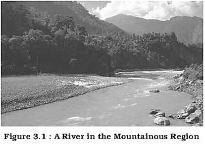
 A river drains the water collected from a specific area, which is called its 'catchment area'. An area drained by a river and its tributaries is called a drainage basin. The boundary line
Important Drainage Patterns
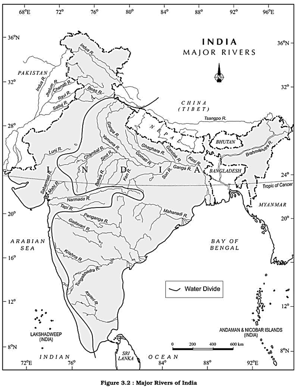
(i) The drainage pattern resembling the branches of a tree is known as "dendritic" the examples of which are the rivers of northern plain.
(ii) When the rivers originate from a hill and flow in all directions, the drainage pattern is known as 'radial'. The rivers originating from the Amarkantak range present a good example of it.
(iii) When the primary tributaries of rivers flow parallel to each other and secondary tributaries join them at right angles, the pattern is known as 'trellis'.
(iv) When the rivers discharge their waters from all directions in a lake or depression, the pattern is know as 'centripetal'.
Find out some of the patterns in the topo sheet given in Chapter 5 of Practical Work in Geography- Part I (NCERT, 2006).
A river drains the water collected from a specific area, which is called its 'catchment area'. An area drained by a river and its tributaries is called a drainage basin. The boundary line
Important Drainage Patterns
(i) The drainage pattern resembling the branches of a tree is known as "dendritic" the examples of which are the rivers of northern plain.
(ii) When the rivers originate from a hill and flow in all directions, the drainage pattern is known as 'radial'. The rivers originating from the Amarkantak range present a good example of it.
(iii) When the primary tributaries of rivers flow parallel to each other and secondary tributaries join them at right angles, the pattern is known as 'trellis'.
(iv) When the rivers discharge their waters from all directions in a lake or depression, the pattern is know as 'centripetal'.
Find out some of the patterns in the topo sheet given in Chapter 5 of Practical Work in Geography- Part I (NCERT, 2006).
 separating one drainage basin from the other is known as the watershed. The catchments of large rivers are called river basins while those of small rivulets and rills are often referred to as watersheds. There is, however, a slight difference between a river basin and a watershed. Watersheds are small in area while the basins cover larger areas.
River basins and watersheds are marked by unity. What happens in one part of the basin or watershed directly affects the other parts and the unit as a more...
separating one drainage basin from the other is known as the watershed. The catchments of large rivers are called river basins while those of small rivulets and rills are often referred to as watersheds. There is, however, a slight difference between a river basin and a watershed. Watersheds are small in area while the basins cover larger areas.
River basins and watersheds are marked by unity. What happens in one part of the basin or watershed directly affects the other parts and the unit as a more... 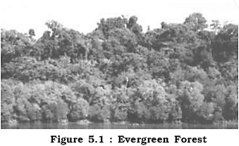
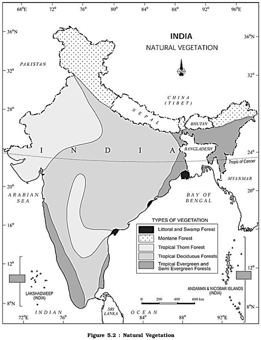 The British were aware of the economic value of the forests in India, hence, large scale exploitation of these forests was started. The structure of forests was also changed. The oak forests in Garhwal and Kumaonwere replaced by pine (chirs) which was needed to lay railway more...


You need to login to perform this action.
You will be redirected in
3 sec

